You are here: Home > Network List > UW - Pacific Northwest Regional Seismic Network Stations List
> Station FISH Seaside, OR, USA > Earthquake Result Viewer
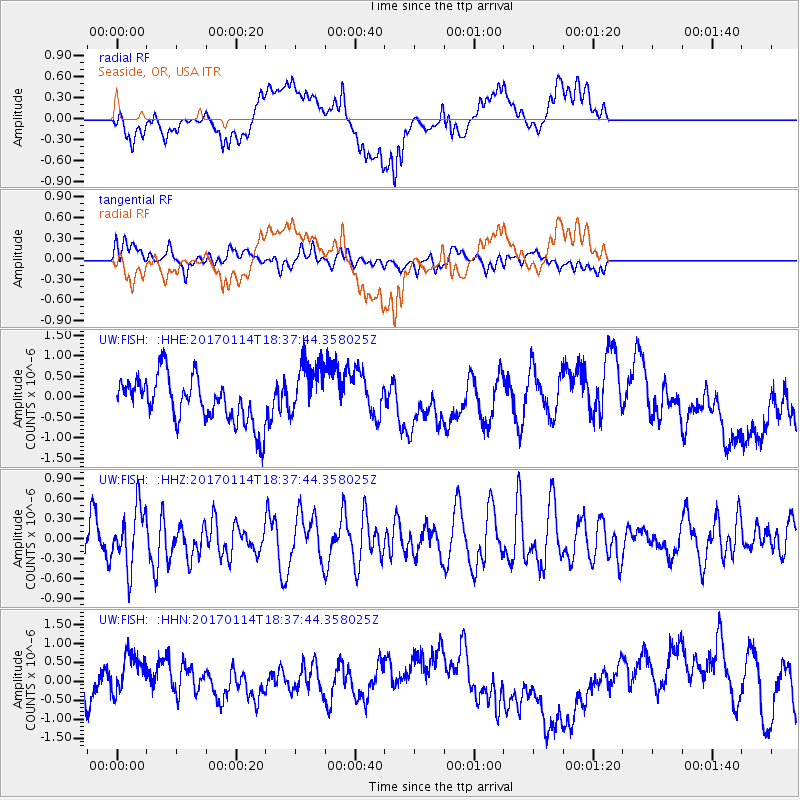
FISH Seaside, OR, USA - Earthquake Result Viewer
*The percent match for this event was below the threshold and hence no stack was calculated.
| Earthquake location: |
Fiji Islands Region |
| Earthquake latitude/longitude: |
-18.7/176.1 |
| Earthquake time(UTC): |
2017/01/14 (014) 18:25:43 GMT |
| Earthquake Depth: |
4.6 km |
| Earthquake Magnitude: |
5.7 Mww |
| Earthquake Catalog/Contributor: |
NEIC PDE/us |
|
| Network: |
UW Pacific Northwest Regional Seismic Network |
| Station: |
FISH Seaside, OR, USA |
| Lat/Lon: |
45.93 N/123.56 W |
| Elevation: |
325 m |
|
| Distance: |
84.3 deg |
| Az: |
37.56 deg |
| Baz: |
235.904 deg |
| Ray Param: |
$rayparam |
*The percent match for this event was below the threshold and hence was not used in the summary stack. |
|
| Radial Match: |
52.59466 % |
| Radial Bump: |
400 |
| Transverse Match: |
42.419765 % |
| Transverse Bump: |
400 |
| SOD ConfigId: |
11737051 |
| Insert Time: |
2019-04-26 15:29:39.043 +0000 |
| GWidth: |
2.5 |
| Max Bumps: |
400 |
| Tol: |
0.001 |
|
Signal To Noise
| Channel | StoN | STA | LTA |
| UW:FISH: :HHZ:20170114T18:37:44.358025Z | 1.382626 | 4.4012697E-7 | 3.183268E-7 |
| UW:FISH: :HHN:20170114T18:37:44.358025Z | 1.4815797 | 6.552326E-7 | 4.422527E-7 |
| UW:FISH: :HHE:20170114T18:37:44.358025Z | 1.298819 | 7.1414274E-7 | 5.4984014E-7 |
| Arrivals |
| Ps | |
| PpPs | |
| PsPs/PpSs | |


