You are here: Home > Network List > BK - Berkeley Digital Seismograph Network Stations List
> Station HUMO Hull Mountain, OR > Earthquake Result Viewer
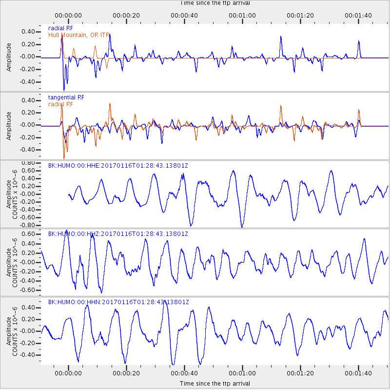
HUMO Hull Mountain, OR - Earthquake Result Viewer
*The percent match for this event was below the threshold and hence no stack was calculated.
| Earthquake location: |
Vanuatu Islands |
| Earthquake latitude/longitude: |
-13.7/166.4 |
| Earthquake time(UTC): |
2017/01/16 (016) 01:16:38 GMT |
| Earthquake Depth: |
10 km |
| Earthquake Magnitude: |
5.8 mb |
| Earthquake Catalog/Contributor: |
NEIC PDE/us |
|
| Network: |
BK Berkeley Digital Seismograph Network |
| Station: |
HUMO Hull Mountain, OR |
| Lat/Lon: |
42.61 N/122.96 W |
| Elevation: |
555 m |
|
| Distance: |
85.4 deg |
| Az: |
44.333 deg |
| Baz: |
246.949 deg |
| Ray Param: |
$rayparam |
*The percent match for this event was below the threshold and hence was not used in the summary stack. |
|
| Radial Match: |
87.389984 % |
| Radial Bump: |
369 |
| Transverse Match: |
64.3178 % |
| Transverse Bump: |
400 |
| SOD ConfigId: |
11737051 |
| Insert Time: |
2019-04-26 15:32:55.615 +0000 |
| GWidth: |
2.5 |
| Max Bumps: |
400 |
| Tol: |
0.001 |
|
Signal To Noise
| Channel | StoN | STA | LTA |
| BK:HUMO:00:HHZ:20170116T01:28:43.13801Z | 2.2882872 | 3.8497095E-7 | 1.6823542E-7 |
| BK:HUMO:00:HHN:20170116T01:28:43.13801Z | 2.3602505 | 2.6993553E-7 | 1.14367324E-7 |
| BK:HUMO:00:HHE:20170116T01:28:43.13801Z | 1.1188959 | 2.2120548E-7 | 1.9769979E-7 |
| Arrivals |
| Ps | |
| PpPs | |
| PsPs/PpSs | |


