DGR Domenigoni Reservoir, California, USA - Earthquake Result Viewer
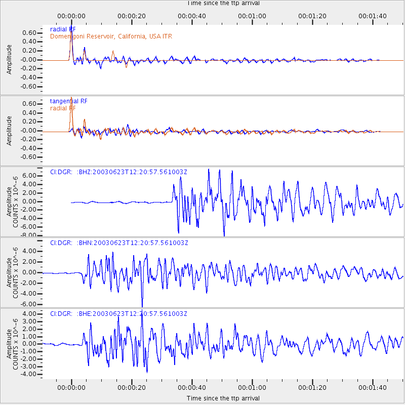
Earthquake location: Rat Islands, Aleutian Islands
Earthquake latitude/longitude: 51.4/176.8
Earthquake time(UTC): 2003/06/23 (174) 12:12:34 GMT
Earthquake Depth: 20 km
Earthquake Magnitude: 6.3 MB, 7.0 MS, 6.9 MW, 6.8 MW
Earthquake Catalog/Contributor: WHDF/NEIC
Network: CI Caltech Regional Seismic Network
Station: DGR Domenigoni Reservoir, California, USA
Lat/Lon: 33.65 N/117.01 W
Elevation: 609 m
Distance: 50.2 deg
Az: 83.811 deg
Baz: 311.757 deg
Ray Param: 0.06822241
Estimated Moho Depth: 27.0 km
Estimated Crust Vp/Vs: 1.96
Assumed Crust Vp: 6.264 km/s
Estimated Crust Vs: 3.192 km/s
Estimated Crust Poisson's Ratio: 0.32
Radial Match: 96.56905 %
Radial Bump: 400
Transverse Match: 88.40469 %
Transverse Bump: 400
SOD ConfigId: 3787
Insert Time: 2010-03-05 21:38:33.829 +0000
GWidth: 2.5
Max Bumps: 400
Tol: 0.001

Signal To Noise

ChannelStoNSTALTA
CI:DGR: :BHN:20030623T12:20:57.561003Z7.8918825.5462505E-77.027792E-8
CI:DGR: :BHE:20030623T12:20:57.561003Z2.7117194.2625553E-71.5719014E-7
CI:DGR: :BHZ:20030623T12:20:57.561003Z9.9547711.1389999E-61.1441749E-7
Arrivals
Ps4.4 SECOND
PpPs12 SECOND
PsPs/PpSs17 SECOND