You are here: Home > Network List > AV - Alaska Volcano Observatory Stations List
> Station SPCR Ckakachatna River, Mount Spurr, Alaska > Earthquake Result Viewer
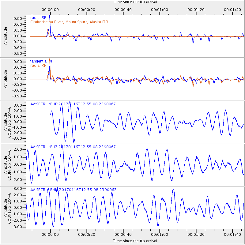
SPCR Ckakachatna River, Mount Spurr, Alaska - Earthquake Result Viewer
*The percent match for this event was below the threshold and hence no stack was calculated.
| Earthquake location: |
Northern Sumatra, Indonesia |
| Earthquake latitude/longitude: |
3.3/98.5 |
| Earthquake time(UTC): |
2017/01/16 (016) 12:42:12 GMT |
| Earthquake Depth: |
10 km |
| Earthquake Magnitude: |
5.7 mb |
| Earthquake Catalog/Contributor: |
NEIC PDE/us |
|
| Network: |
AV Alaska Volcano Observatory |
| Station: |
SPCR Ckakachatna River, Mount Spurr, Alaska |
| Lat/Lon: |
61.20 N/152.21 W |
| Elevation: |
984 m |
|
| Distance: |
96.3 deg |
| Az: |
27.385 deg |
| Baz: |
288.493 deg |
| Ray Param: |
$rayparam |
*The percent match for this event was below the threshold and hence was not used in the summary stack. |
|
| Radial Match: |
75.09728 % |
| Radial Bump: |
400 |
| Transverse Match: |
58.074974 % |
| Transverse Bump: |
400 |
| SOD ConfigId: |
11737051 |
| Insert Time: |
2019-04-26 15:38:55.943 +0000 |
| GWidth: |
2.5 |
| Max Bumps: |
400 |
| Tol: |
0.001 |
|
Signal To Noise
| Channel | StoN | STA | LTA |
| AV:SPCR: :BHZ:20170116T12:55:08.239006Z | 0.7951428 | 1.2301887E-6 | 1.5471292E-6 |
| AV:SPCR: :BHN:20170116T12:55:08.239006Z | 1.953645 | 2.218331E-6 | 1.1354832E-6 |
| AV:SPCR: :BHE:20170116T12:55:08.239006Z | 0.19893347 | 3.62899E-7 | 1.8242229E-6 |
| Arrivals |
| Ps | |
| PpPs | |
| PsPs/PpSs | |


