You are here: Home > Network List > CI - Caltech Regional Seismic Network Stations List
> Station DGR Domenigoni Reservoir, California, USA > Earthquake Result Viewer
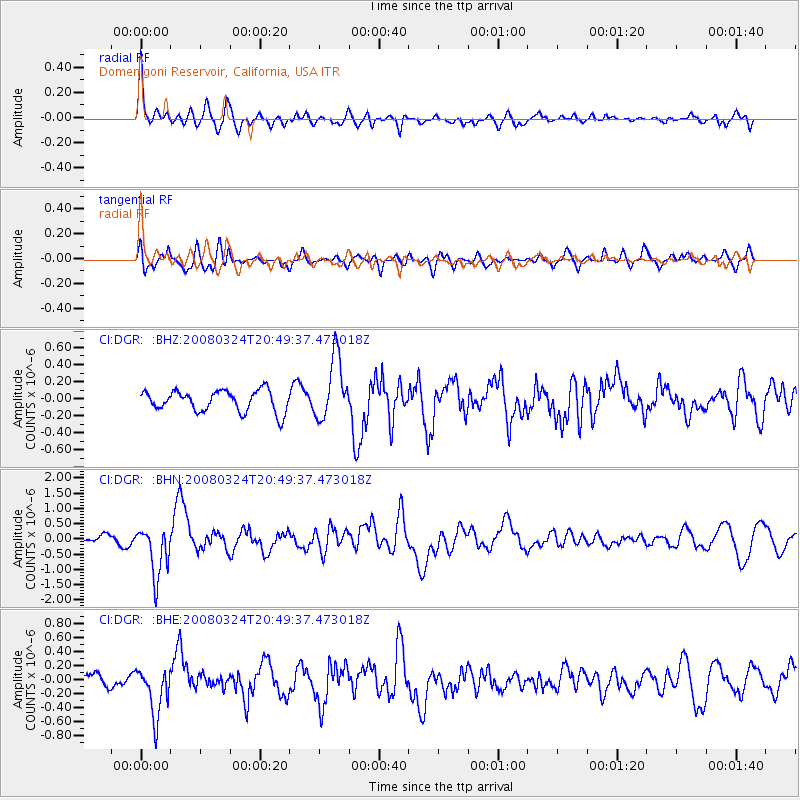
DGR Domenigoni Reservoir, California, USA - Earthquake Result Viewer
*The percent match for this event was below the threshold and hence no stack was calculated.
| Earthquake location: |
Chile-Bolivia Border Region |
| Earthquake latitude/longitude: |
-20.0/-69.0 |
| Earthquake time(UTC): |
2008/03/24 (084) 20:39:07 GMT |
| Earthquake Depth: |
120 km |
| Earthquake Magnitude: |
5.7 MB, 6.2 MW, 6.1 MW |
| Earthquake Catalog/Contributor: |
WHDF/NEIC |
|
| Network: |
CI Caltech Regional Seismic Network |
| Station: |
DGR Domenigoni Reservoir, California, USA |
| Lat/Lon: |
33.65 N/117.01 W |
| Elevation: |
609 m |
|
| Distance: |
70.3 deg |
| Az: |
318.797 deg |
| Baz: |
132.059 deg |
| Ray Param: |
$rayparam |
*The percent match for this event was below the threshold and hence was not used in the summary stack. |
|
| Radial Match: |
76.92595 % |
| Radial Bump: |
400 |
| Transverse Match: |
69.71558 % |
| Transverse Bump: |
400 |
| SOD ConfigId: |
2504 |
| Insert Time: |
2010-03-05 21:39:24.593 +0000 |
| GWidth: |
2.5 |
| Max Bumps: |
400 |
| Tol: |
0.001 |
|
Signal To Noise
| Channel | StoN | STA | LTA |
| CI:DGR: :BHN:20080324T20:49:37.473018Z | 6.893716 | 8.2690696E-7 | 1.1995084E-7 |
| CI:DGR: :BHE:20080324T20:49:37.473018Z | 2.6618443 | 3.5034748E-7 | 1.3161832E-7 |
| CI:DGR: :BHZ:20080324T20:49:37.473018Z | 2.96615 | 3.663329E-7 | 1.235045E-7 |
| Arrivals |
| Ps | |
| PpPs | |
| PsPs/PpSs | |


