You are here: Home > Network List > G - GEOSCOPE Stations List
> Station WUS Wushi, Xinjiang Uygur, China > Earthquake Result Viewer
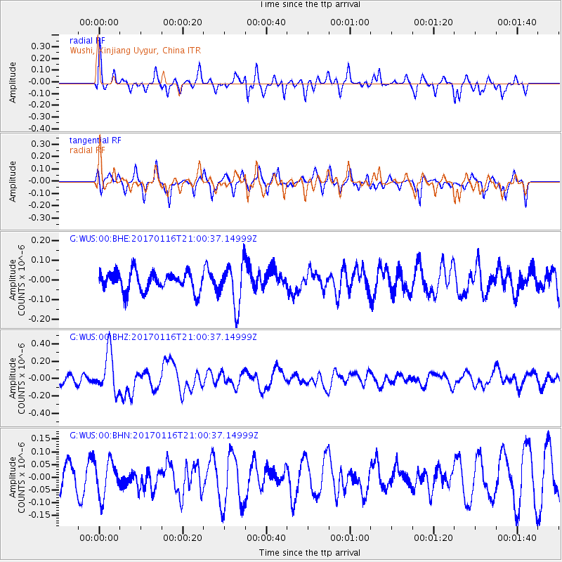
WUS Wushi, Xinjiang Uygur, China - Earthquake Result Viewer
*The percent match for this event was below the threshold and hence no stack was calculated.
| Earthquake location: |
Vanuatu Islands |
| Earthquake latitude/longitude: |
-13.5/166.5 |
| Earthquake time(UTC): |
2017/01/16 (016) 20:47:38 GMT |
| Earthquake Depth: |
10 km |
| Earthquake Magnitude: |
5.7 Mwb |
| Earthquake Catalog/Contributor: |
NEIC PDE/us |
|
| Network: |
G GEOSCOPE |
| Station: |
WUS Wushi, Xinjiang Uygur, China |
| Lat/Lon: |
41.20 N/79.22 E |
| Elevation: |
1457 m |
|
| Distance: |
96.7 deg |
| Az: |
310.63 deg |
| Baz: |
101.933 deg |
| Ray Param: |
$rayparam |
*The percent match for this event was below the threshold and hence was not used in the summary stack. |
|
| Radial Match: |
65.720436 % |
| Radial Bump: |
369 |
| Transverse Match: |
52.92248 % |
| Transverse Bump: |
271 |
| SOD ConfigId: |
11737051 |
| Insert Time: |
2019-04-26 15:45:05.021 +0000 |
| GWidth: |
2.5 |
| Max Bumps: |
400 |
| Tol: |
0.001 |
|
Signal To Noise
| Channel | StoN | STA | LTA |
| G:WUS:00:BHZ:20170116T21:00:37.14999Z | 4.93323 | 2.382549E-7 | 4.8295924E-8 |
| G:WUS:00:BHN:20170116T21:00:37.14999Z | 1.6204684 | 6.8957725E-8 | 4.255419E-8 |
| G:WUS:00:BHE:20170116T21:00:37.14999Z | 2.3571057 | 1.1504969E-7 | 4.8809728E-8 |
| Arrivals |
| Ps | |
| PpPs | |
| PsPs/PpSs | |


