You are here: Home > Network List > CI - Caltech Regional Seismic Network Stations List
> Station DGR Domenigoni Reservoir, California, USA > Earthquake Result Viewer
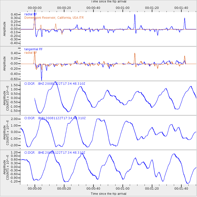
DGR Domenigoni Reservoir, California, USA - Earthquake Result Viewer
*The percent match for this event was below the threshold and hence no stack was calculated.
| Earthquake location: |
Southeast Of Loyalty Islands |
| Earthquake latitude/longitude: |
-22.4/171.2 |
| Earthquake time(UTC): |
2008/11/22 (327) 17:22:36 GMT |
| Earthquake Depth: |
69 km |
| Earthquake Magnitude: |
5.5 MB |
| Earthquake Catalog/Contributor: |
WHDF/NEIC |
|
| Network: |
CI Caltech Regional Seismic Network |
| Station: |
DGR Domenigoni Reservoir, California, USA |
| Lat/Lon: |
33.65 N/117.01 W |
| Elevation: |
609 m |
|
| Distance: |
88.1 deg |
| Az: |
52.431 deg |
| Baz: |
241.535 deg |
| Ray Param: |
$rayparam |
*The percent match for this event was below the threshold and hence was not used in the summary stack. |
|
| Radial Match: |
74.04842 % |
| Radial Bump: |
400 |
| Transverse Match: |
89.534325 % |
| Transverse Bump: |
363 |
| SOD ConfigId: |
2658 |
| Insert Time: |
2010-03-05 21:39:54.440 +0000 |
| GWidth: |
2.5 |
| Max Bumps: |
400 |
| Tol: |
0.001 |
|
Signal To Noise
| Channel | StoN | STA | LTA |
| CI:DGR: :BHN:20081122T17:34:48.310Z | 0.8270657 | 1.1404437E-6 | 1.3789033E-6 |
| CI:DGR: :BHE:20081122T17:34:48.310Z | 2.6877167 | 1.0775512E-6 | 4.0091697E-7 |
| CI:DGR: :BHZ:20081122T17:34:48.310Z | 1.0676973 | 1.311898E-6 | 1.2287172E-6 |
| Arrivals |
| Ps | |
| PpPs | |
| PsPs/PpSs | |


