You are here: Home > Network List > CI - Caltech Regional Seismic Network Stations List
> Station DGR Domenigoni Reservoir, California, USA > Earthquake Result Viewer
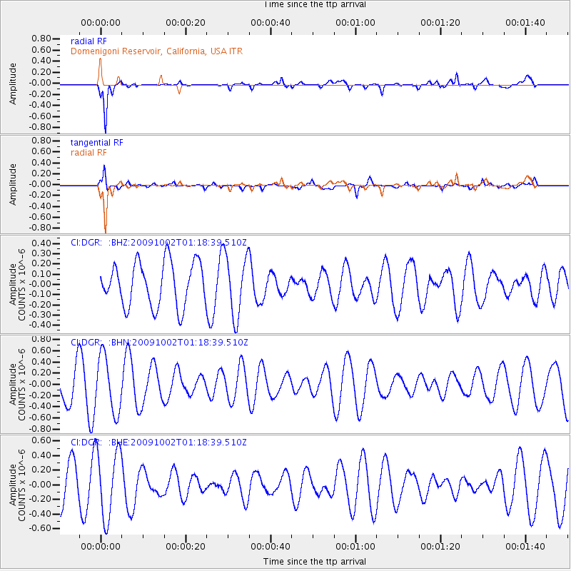
DGR Domenigoni Reservoir, California, USA - Earthquake Result Viewer
*The percent match for this event was below the threshold and hence no stack was calculated.
| Earthquake location: |
Tonga Islands |
| Earthquake latitude/longitude: |
-16.3/-173.5 |
| Earthquake time(UTC): |
2009/10/02 (275) 01:07:39 GMT |
| Earthquake Depth: |
8.0 km |
| Earthquake Magnitude: |
6.1 MB, 6.0 MS, 6.1 MW, 6.1 MW |
| Earthquake Catalog/Contributor: |
WHDF/NEIC |
|
| Network: |
CI Caltech Regional Seismic Network |
| Station: |
DGR Domenigoni Reservoir, California, USA |
| Lat/Lon: |
33.65 N/117.01 W |
| Elevation: |
609 m |
|
| Distance: |
73.2 deg |
| Az: |
46.561 deg |
| Baz: |
236.698 deg |
| Ray Param: |
$rayparam |
*The percent match for this event was below the threshold and hence was not used in the summary stack. |
|
| Radial Match: |
81.78782 % |
| Radial Bump: |
380 |
| Transverse Match: |
61.435894 % |
| Transverse Bump: |
346 |
| SOD ConfigId: |
2622 |
| Insert Time: |
2010-03-05 21:40:12.999 +0000 |
| GWidth: |
2.5 |
| Max Bumps: |
400 |
| Tol: |
0.001 |
|
Signal To Noise
| Channel | StoN | STA | LTA |
| CI:DGR: :BHN:20091002T01:18:39.510Z | 1.9484733 | 5.0628125E-7 | 2.5983485E-7 |
| CI:DGR: :BHE:20091002T01:18:39.510Z | 1.7379377 | 4.6186503E-7 | 2.6575466E-7 |
| CI:DGR: :BHZ:20091002T01:18:39.510Z | 1.3966022 | 2.981323E-7 | 2.1346975E-7 |
| Arrivals |
| Ps | |
| PpPs | |
| PsPs/PpSs | |


