You are here: Home > Network List > TA - USArray Transportable Network (new EarthScope stations) Stations List
> Station H17A Grant Village (NPS), Yellowstone Nt. Park, WY, USA > Earthquake Result Viewer
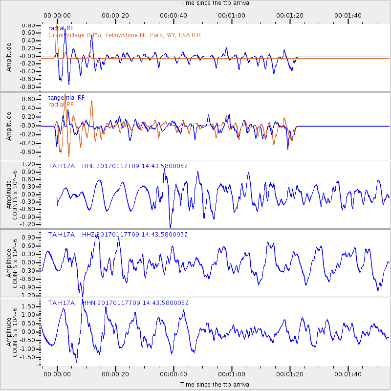
H17A Grant Village (NPS), Yellowstone Nt. Park, WY, USA - Earthquake Result Viewer
*The percent match for this event was below the threshold and hence no stack was calculated.
| Earthquake location: |
Cuba Region |
| Earthquake latitude/longitude: |
19.9/-76.6 |
| Earthquake time(UTC): |
2017/01/17 (017) 09:08:01 GMT |
| Earthquake Depth: |
10 km |
| Earthquake Magnitude: |
5.8 Mww |
| Earthquake Catalog/Contributor: |
NEIC PDE/us |
|
| Network: |
TA USArray Transportable Network (new EarthScope stations) |
| Station: |
H17A Grant Village (NPS), Yellowstone Nt. Park, WY, USA |
| Lat/Lon: |
44.40 N/110.58 W |
| Elevation: |
2400 m |
|
| Distance: |
37.3 deg |
| Az: |
318.664 deg |
| Baz: |
119.87 deg |
| Ray Param: |
$rayparam |
*The percent match for this event was below the threshold and hence was not used in the summary stack. |
|
| Radial Match: |
67.427155 % |
| Radial Bump: |
400 |
| Transverse Match: |
46.368954 % |
| Transverse Bump: |
400 |
| SOD ConfigId: |
11737051 |
| Insert Time: |
2019-04-26 15:54:17.232 +0000 |
| GWidth: |
2.5 |
| Max Bumps: |
400 |
| Tol: |
0.001 |
|
Signal To Noise
| Channel | StoN | STA | LTA |
| TA:H17A: :HHZ:20170117T09:14:43.580005Z | 1.8161039 | 2.6270394E-7 | 1.4465247E-7 |
| TA:H17A: :HHN:20170117T09:14:43.580005Z | 1.6744639 | 8.3774574E-7 | 5.0030684E-7 |
| TA:H17A: :HHE:20170117T09:14:43.580005Z | 1.0583074 | 3.3812907E-7 | 3.1949986E-7 |
| Arrivals |
| Ps | |
| PpPs | |
| PsPs/PpSs | |


