You are here: Home > Network List > G - GEOSCOPE Stations List
> Station WUS Wushi, Xinjiang Uygur, China > Earthquake Result Viewer
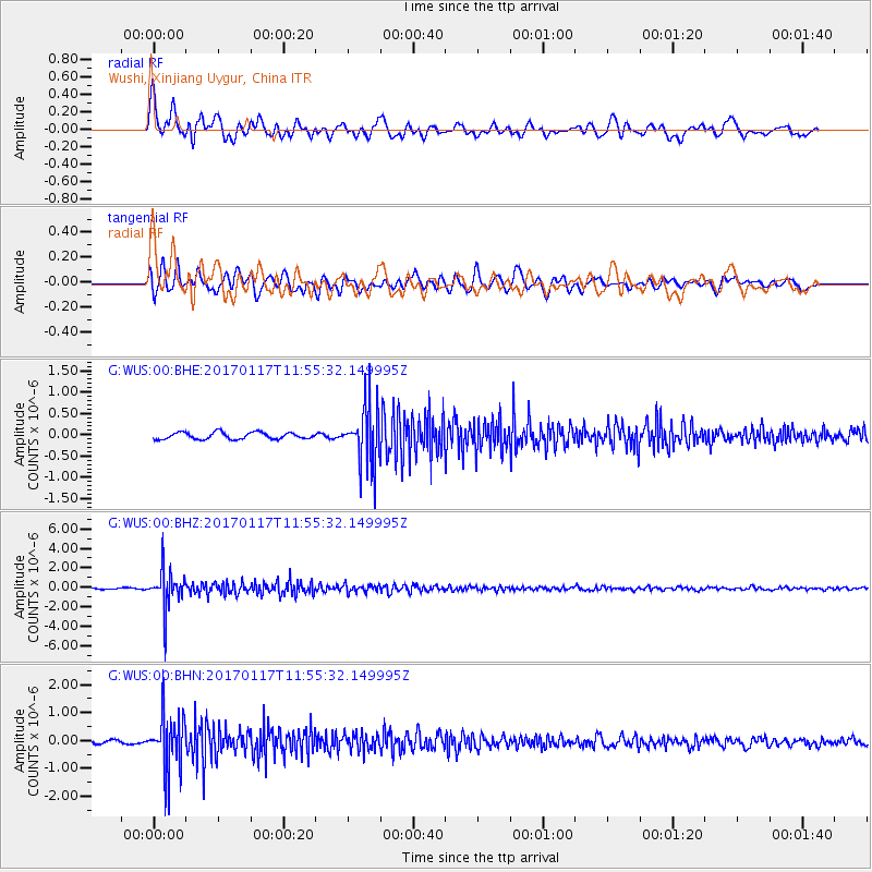
WUS Wushi, Xinjiang Uygur, China - Earthquake Result Viewer
*The percent match for this event was below the threshold and hence no stack was calculated.
| Earthquake location: |
Northern Sumatra, Indonesia |
| Earthquake latitude/longitude: |
5.4/94.6 |
| Earthquake time(UTC): |
2017/01/17 (017) 11:48:48 GMT |
| Earthquake Depth: |
55 km |
| Earthquake Magnitude: |
5.6 mb |
| Earthquake Catalog/Contributor: |
NEIC PDE/us |
|
| Network: |
G GEOSCOPE |
| Station: |
WUS Wushi, Xinjiang Uygur, China |
| Lat/Lon: |
41.20 N/79.22 E |
| Elevation: |
1457 m |
|
| Distance: |
38.2 deg |
| Az: |
341.098 deg |
| Baz: |
154.697 deg |
| Ray Param: |
$rayparam |
*The percent match for this event was below the threshold and hence was not used in the summary stack. |
|
| Radial Match: |
78.03603 % |
| Radial Bump: |
400 |
| Transverse Match: |
76.224205 % |
| Transverse Bump: |
400 |
| SOD ConfigId: |
11737051 |
| Insert Time: |
2019-04-26 15:57:47.581 +0000 |
| GWidth: |
2.5 |
| Max Bumps: |
400 |
| Tol: |
0.001 |
|
Signal To Noise
| Channel | StoN | STA | LTA |
| G:WUS:00:BHZ:20170117T11:55:32.149995Z | 39.77573 | 1.9139163E-6 | 4.811769E-8 |
| G:WUS:00:BHN:20170117T11:55:32.149995Z | 18.332424 | 9.747843E-7 | 5.3172695E-8 |
| G:WUS:00:BHE:20170117T11:55:32.149995Z | 9.098497 | 7.099214E-7 | 7.802622E-8 |
| Arrivals |
| Ps | |
| PpPs | |
| PsPs/PpSs | |


