You are here: Home > Network List > CI - Caltech Regional Seismic Network Stations List
> Station DGR Domenigoni Reservoir, California, USA > Earthquake Result Viewer
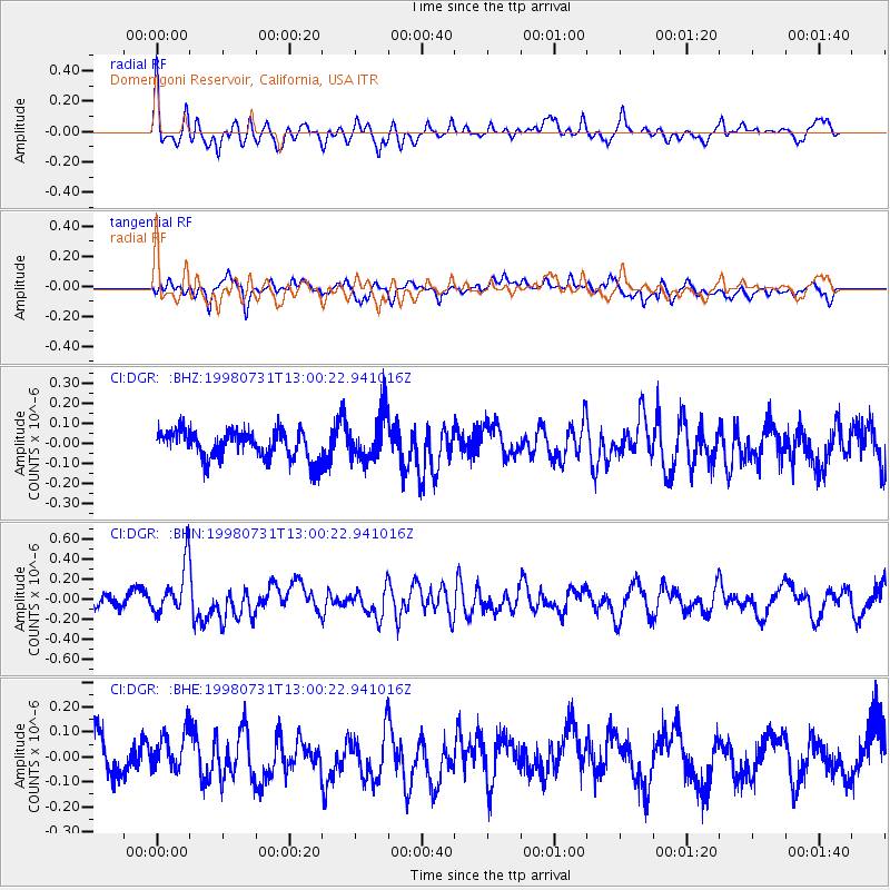
DGR Domenigoni Reservoir, California, USA - Earthquake Result Viewer
*The percent match for this event was below the threshold and hence no stack was calculated.
| Earthquake location: |
Southeast Of Loyalty Islands |
| Earthquake latitude/longitude: |
-21.6/169.9 |
| Earthquake time(UTC): |
1998/07/31 (212) 12:48:04 GMT |
| Earthquake Depth: |
33 km |
| Earthquake Magnitude: |
5.5 MB, 5.3 MS, 5.8 UNKNOWN |
| Earthquake Catalog/Contributor: |
WHDF/NEIC |
|
| Network: |
CI Caltech Regional Seismic Network |
| Station: |
DGR Domenigoni Reservoir, California, USA |
| Lat/Lon: |
33.65 N/117.01 W |
| Elevation: |
609 m |
|
| Distance: |
88.6 deg |
| Az: |
52.961 deg |
| Baz: |
242.908 deg |
| Ray Param: |
$rayparam |
*The percent match for this event was below the threshold and hence was not used in the summary stack. |
|
| Radial Match: |
59.385395 % |
| Radial Bump: |
400 |
| Transverse Match: |
49.069145 % |
| Transverse Bump: |
400 |
| SOD ConfigId: |
4480 |
| Insert Time: |
2010-03-05 21:40:38.198 +0000 |
| GWidth: |
2.5 |
| Max Bumps: |
400 |
| Tol: |
0.001 |
|
Signal To Noise
| Channel | StoN | STA | LTA |
| CI:DGR: :BHN:19980731T13:00:22.941016Z | 3.5249195 | 2.57028E-7 | 7.291741E-8 |
| CI:DGR: :BHE:19980731T13:00:22.941016Z | 1.0982764 | 7.6416335E-8 | 6.957842E-8 |
| CI:DGR: :BHZ:19980731T13:00:22.941016Z | 1.6255797 | 1.1617548E-7 | 7.1467106E-8 |
| Arrivals |
| Ps | |
| PpPs | |
| PsPs/PpSs | |


