You are here: Home > Network List > TJ - Tajikistan National Seismic Network Stations List
> Station GARM Garm, Tajikistan > Earthquake Result Viewer
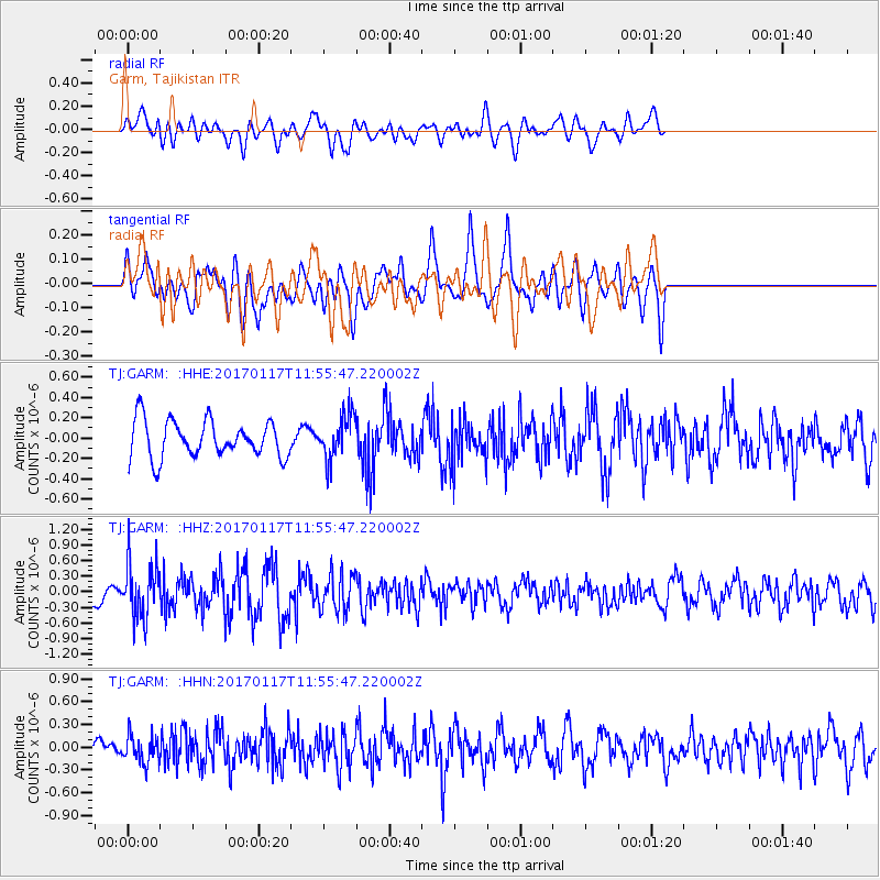
GARM Garm, Tajikistan - Earthquake Result Viewer
*The percent match for this event was below the threshold and hence no stack was calculated.
| Earthquake location: |
Northern Sumatra, Indonesia |
| Earthquake latitude/longitude: |
5.4/94.6 |
| Earthquake time(UTC): |
2017/01/17 (017) 11:48:48 GMT |
| Earthquake Depth: |
55 km |
| Earthquake Magnitude: |
5.6 mb |
| Earthquake Catalog/Contributor: |
NEIC PDE/us |
|
| Network: |
TJ Tajikistan National Seismic Network |
| Station: |
GARM Garm, Tajikistan |
| Lat/Lon: |
39.00 N/70.32 E |
| Elevation: |
1305 m |
|
| Distance: |
40.0 deg |
| Az: |
330.089 deg |
| Baz: |
140.422 deg |
| Ray Param: |
$rayparam |
*The percent match for this event was below the threshold and hence was not used in the summary stack. |
|
| Radial Match: |
60.556686 % |
| Radial Bump: |
400 |
| Transverse Match: |
63.333904 % |
| Transverse Bump: |
400 |
| SOD ConfigId: |
11737051 |
| Insert Time: |
2019-04-26 15:59:51.361 +0000 |
| GWidth: |
2.5 |
| Max Bumps: |
400 |
| Tol: |
0.001 |
|
Signal To Noise
| Channel | StoN | STA | LTA |
| TJ:GARM: :HHZ:20170117T11:55:47.220002Z | 3.170689 | 5.2197095E-7 | 1.6462383E-7 |
| TJ:GARM: :HHN:20170117T11:55:47.220002Z | 1.3244573 | 1.762016E-7 | 1.3303682E-7 |
| TJ:GARM: :HHE:20170117T11:55:47.220002Z | 1.2609048 | 2.2435184E-7 | 1.7792925E-7 |
| Arrivals |
| Ps | |
| PpPs | |
| PsPs/PpSs | |


