You are here: Home > Network List > AK - Alaska Regional Network Stations List
> Station CUT Chulitna, AK, USA > Earthquake Result Viewer
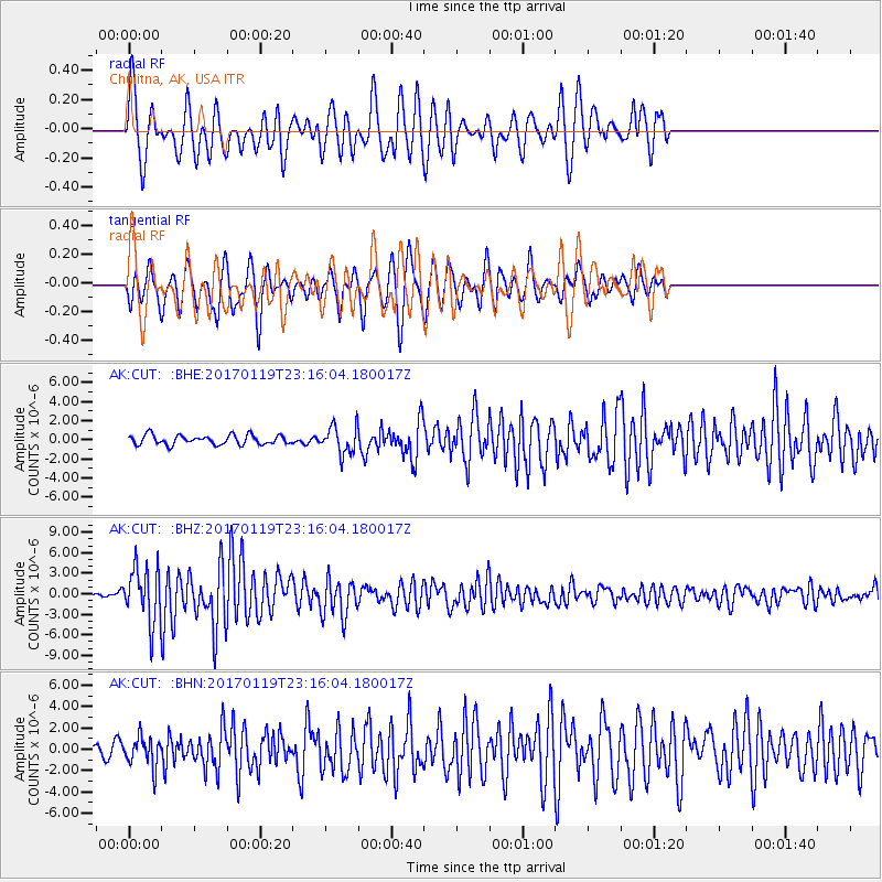
CUT Chulitna, AK, USA - Earthquake Result Viewer
*The percent match for this event was below the threshold and hence no stack was calculated.
| Earthquake location: |
Solomon Islands |
| Earthquake latitude/longitude: |
-10.4/161.3 |
| Earthquake time(UTC): |
2017/01/19 (019) 23:04:20 GMT |
| Earthquake Depth: |
34 km |
| Earthquake Magnitude: |
6.8 mwp |
| Earthquake Catalog/Contributor: |
NEIC PDE/us |
|
| Network: |
AK Alaska Regional Network |
| Station: |
CUT Chulitna, AK, USA |
| Lat/Lon: |
62.41 N/150.26 W |
| Elevation: |
574 m |
|
| Distance: |
81.6 deg |
| Az: |
20.628 deg |
| Baz: |
228.109 deg |
| Ray Param: |
$rayparam |
*The percent match for this event was below the threshold and hence was not used in the summary stack. |
|
| Radial Match: |
78.05936 % |
| Radial Bump: |
400 |
| Transverse Match: |
73.55151 % |
| Transverse Bump: |
400 |
| SOD ConfigId: |
11737051 |
| Insert Time: |
2019-04-26 16:07:04.572 +0000 |
| GWidth: |
2.5 |
| Max Bumps: |
400 |
| Tol: |
0.001 |
|
Signal To Noise
| Channel | StoN | STA | LTA |
| AK:CUT: :BHZ:20170119T23:16:04.180017Z | 14.915493 | 4.0529153E-6 | 2.7172518E-7 |
| AK:CUT: :BHN:20170119T23:16:04.180017Z | 2.0254138 | 1.3831683E-6 | 6.8290655E-7 |
| AK:CUT: :BHE:20170119T23:16:04.180017Z | 2.7271302 | 1.3480911E-6 | 4.943259E-7 |
| Arrivals |
| Ps | |
| PpPs | |
| PsPs/PpSs | |


