You are here: Home > Network List > CI - Caltech Regional Seismic Network Stations List
> Station SMM Simmler, CA, USA > Earthquake Result Viewer
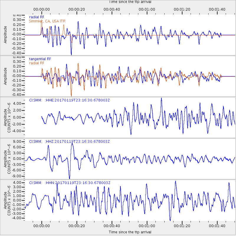
SMM Simmler, CA, USA - Earthquake Result Viewer
*The percent match for this event was below the threshold and hence no stack was calculated.
| Earthquake location: |
Solomon Islands |
| Earthquake latitude/longitude: |
-10.4/161.3 |
| Earthquake time(UTC): |
2017/01/19 (019) 23:04:20 GMT |
| Earthquake Depth: |
34 km |
| Earthquake Magnitude: |
6.8 mwp |
| Earthquake Catalog/Contributor: |
NEIC PDE/us |
|
| Network: |
CI Caltech Regional Seismic Network |
| Station: |
SMM Simmler, CA, USA |
| Lat/Lon: |
35.31 N/120.00 W |
| Elevation: |
599 m |
|
| Distance: |
86.9 deg |
| Az: |
53.44 deg |
| Baz: |
255.103 deg |
| Ray Param: |
$rayparam |
*The percent match for this event was below the threshold and hence was not used in the summary stack. |
|
| Radial Match: |
76.12661 % |
| Radial Bump: |
400 |
| Transverse Match: |
57.020267 % |
| Transverse Bump: |
400 |
| SOD ConfigId: |
11737051 |
| Insert Time: |
2019-04-26 16:10:58.342 +0000 |
| GWidth: |
2.5 |
| Max Bumps: |
400 |
| Tol: |
0.001 |
|
Signal To Noise
| Channel | StoN | STA | LTA |
| CI:SMM: :HHZ:20170119T23:16:30.678003Z | 6.184366 | 2.6587807E-6 | 4.2991965E-7 |
| CI:SMM: :HHN:20170119T23:16:30.678003Z | 0.6533182 | 9.3334086E-7 | 1.4286161E-6 |
| CI:SMM: :HHE:20170119T23:16:30.678003Z | 0.96971905 | 8.109473E-7 | 8.362703E-7 |
| Arrivals |
| Ps | |
| PpPs | |
| PsPs/PpSs | |


