You are here: Home > Network List > CI - Caltech Regional Seismic Network Stations List
> Station DGR Domenigoni Reservoir, California, USA > Earthquake Result Viewer
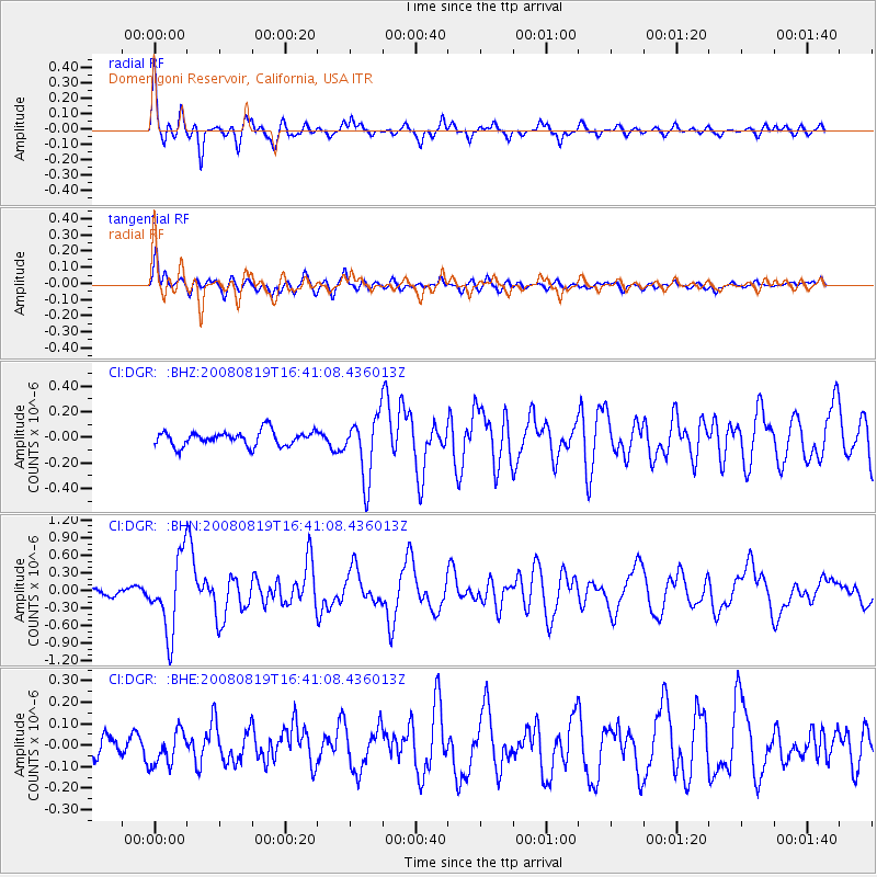
DGR Domenigoni Reservoir, California, USA - Earthquake Result Viewer
*The percent match for this event was below the threshold and hence no stack was calculated.
| Earthquake location: |
Tonga Islands |
| Earthquake latitude/longitude: |
-15.1/-173.5 |
| Earthquake time(UTC): |
2008/08/19 (232) 16:30:13 GMT |
| Earthquake Depth: |
8.0 km |
| Earthquake Magnitude: |
5.6 MB, 5.9 MS, 6.1 MW, 6.0 MW |
| Earthquake Catalog/Contributor: |
WHDF/NEIC |
|
| Network: |
CI Caltech Regional Seismic Network |
| Station: |
DGR Domenigoni Reservoir, California, USA |
| Lat/Lon: |
33.65 N/117.01 W |
| Elevation: |
609 m |
|
| Distance: |
72.4 deg |
| Az: |
46.843 deg |
| Baz: |
237.647 deg |
| Ray Param: |
$rayparam |
*The percent match for this event was below the threshold and hence was not used in the summary stack. |
|
| Radial Match: |
78.91907 % |
| Radial Bump: |
384 |
| Transverse Match: |
80.28053 % |
| Transverse Bump: |
400 |
| SOD ConfigId: |
2504 |
| Insert Time: |
2010-03-05 21:42:43.387 +0000 |
| GWidth: |
2.5 |
| Max Bumps: |
400 |
| Tol: |
0.001 |
|
Signal To Noise
| Channel | StoN | STA | LTA |
| CI:DGR: :BHN:20080819T16:41:08.436013Z | 10.901652 | 6.3334346E-7 | 5.80961E-8 |
| CI:DGR: :BHE:20080819T16:41:08.436013Z | 1.2053174 | 7.884697E-8 | 6.5415946E-8 |
| CI:DGR: :BHZ:20080819T16:41:08.436013Z | 4.2504454 | 2.429132E-7 | 5.7150057E-8 |
| Arrivals |
| Ps | |
| PpPs | |
| PsPs/PpSs | |


