You are here: Home > Network List > CI - Caltech Regional Seismic Network Stations List
> Station DGR Domenigoni Reservoir, California, USA > Earthquake Result Viewer
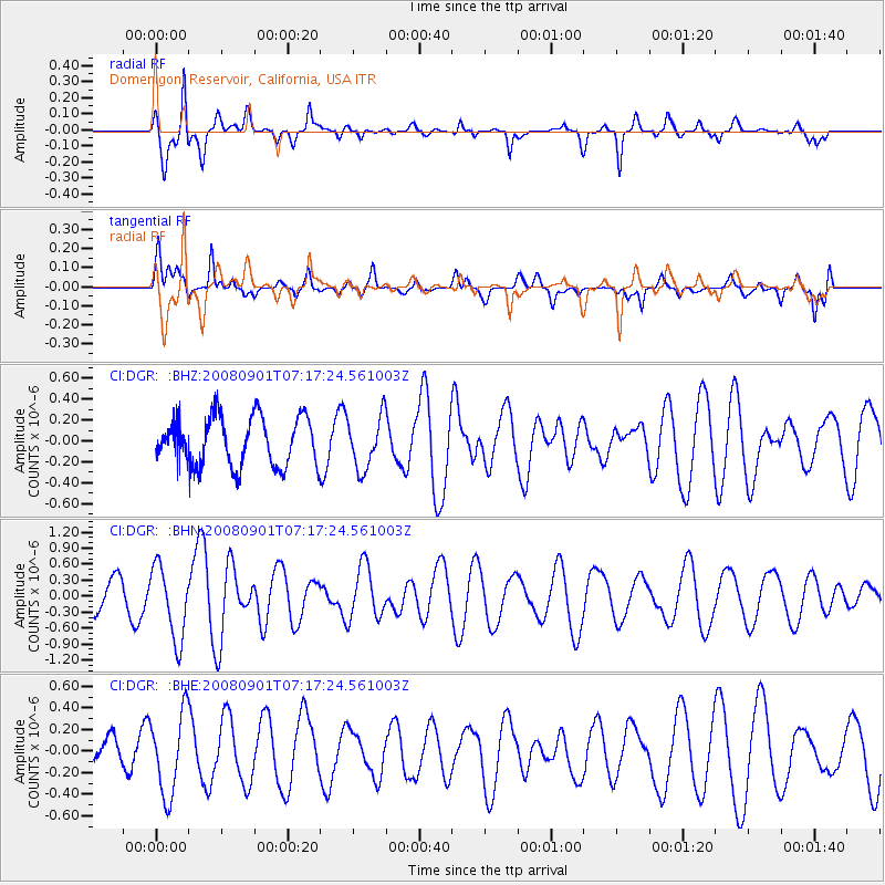
DGR Domenigoni Reservoir, California, USA - Earthquake Result Viewer
*The percent match for this event was below the threshold and hence no stack was calculated.
| Earthquake location: |
Fiji Islands Region |
| Earthquake latitude/longitude: |
-15.3/-176.4 |
| Earthquake time(UTC): |
2008/09/01 (245) 07:06:16 GMT |
| Earthquake Depth: |
10 km |
| Earthquake Magnitude: |
5.6 MS, 5.4 MB, 5.7 MW, 5.7 MW |
| Earthquake Catalog/Contributor: |
WHDF/NEIC |
|
| Network: |
CI Caltech Regional Seismic Network |
| Station: |
DGR Domenigoni Reservoir, California, USA |
| Lat/Lon: |
33.65 N/117.01 W |
| Elevation: |
609 m |
|
| Distance: |
74.6 deg |
| Az: |
48.137 deg |
| Baz: |
239.512 deg |
| Ray Param: |
$rayparam |
*The percent match for this event was below the threshold and hence was not used in the summary stack. |
|
| Radial Match: |
84.89589 % |
| Radial Bump: |
377 |
| Transverse Match: |
60.69766 % |
| Transverse Bump: |
400 |
| SOD ConfigId: |
2504 |
| Insert Time: |
2010-03-05 21:42:50.646 +0000 |
| GWidth: |
2.5 |
| Max Bumps: |
400 |
| Tol: |
0.001 |
|
Signal To Noise
| Channel | StoN | STA | LTA |
| CI:DGR: :BHN:20080901T07:17:24.561003Z | 2.984054 | 6.8924834E-7 | 2.3097715E-7 |
| CI:DGR: :BHE:20080901T07:17:24.561003Z | 1.500089 | 3.7883314E-7 | 2.5254042E-7 |
| CI:DGR: :BHZ:20080901T07:17:24.561003Z | 1.076756 | 2.487923E-7 | 2.3105726E-7 |
| Arrivals |
| Ps | |
| PpPs | |
| PsPs/PpSs | |


