You are here: Home > Network List > TA - USArray Transportable Network (new EarthScope stations) Stations List
> Station R32K Eaglecrest, AK, USA > Earthquake Result Viewer
R32K Eaglecrest, AK, USA - Earthquake Result Viewer
*The percent match for this event was below the threshold and hence no stack was calculated.
| Earthquake location: |
Solomon Islands |
| Earthquake latitude/longitude: |
-10.4/161.3 |
| Earthquake time(UTC): |
2017/01/19 (019) 23:04:20 GMT |
| Earthquake Depth: |
34 km |
| Earthquake Magnitude: |
6.8 mwp |
| Earthquake Catalog/Contributor: |
NEIC PDE/us |
|
| Network: |
TA USArray Transportable Network (new EarthScope stations) |
| Station: |
R32K Eaglecrest, AK, USA |
| Lat/Lon: |
58.27 N/134.52 W |
| Elevation: |
386 m |
|
| Distance: |
85.7 deg |
| Az: |
28.495 deg |
| Baz: |
242.668 deg |
| Ray Param: |
$rayparam |
*The percent match for this event was below the threshold and hence was not used in the summary stack. |
|
| Radial Match: |
57.939163 % |
| Radial Bump: |
400 |
| Transverse Match: |
61.435593 % |
| Transverse Bump: |
400 |
| SOD ConfigId: |
11737051 |
| Insert Time: |
2019-04-26 16:15:36.979 +0000 |
| GWidth: |
2.5 |
| Max Bumps: |
400 |
| Tol: |
0.001 |
|
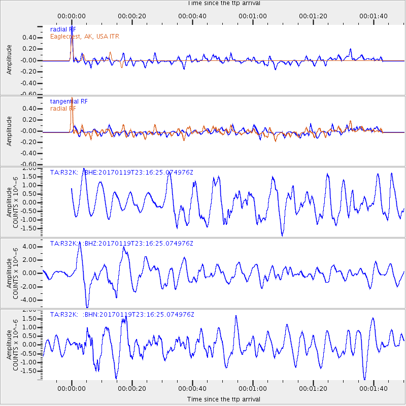
Signal To Noise
| Channel | StoN | STA | LTA |
| TA:R32K: :BHZ:20170119T23:16:25.074976Z | 5.0479727 | 2.3641137E-6 | 4.6832935E-7 |
| TA:R32K: :BHN:20170119T23:16:25.074976Z | 0.44892412 | 2.4148108E-7 | 5.3791064E-7 |
| TA:R32K: :BHE:20170119T23:16:25.074976Z | 1.317068 | 8.7815187E-7 | 6.6674755E-7 |
| Arrivals |
| Ps | |
| PpPs | |
| PsPs/PpSs | |


