You are here: Home > Network List > UW - Pacific Northwest Regional Seismic Network Stations List
> Station LEBA Lebam, WA, USA > Earthquake Result Viewer
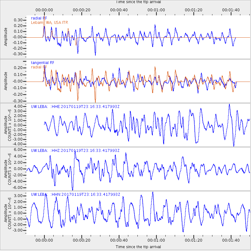
LEBA Lebam, WA, USA - Earthquake Result Viewer
*The percent match for this event was below the threshold and hence no stack was calculated.
| Earthquake location: |
Solomon Islands |
| Earthquake latitude/longitude: |
-10.4/161.3 |
| Earthquake time(UTC): |
2017/01/19 (019) 23:04:20 GMT |
| Earthquake Depth: |
34 km |
| Earthquake Magnitude: |
6.8 mwp |
| Earthquake Catalog/Contributor: |
NEIC PDE/us |
|
| Network: |
UW Pacific Northwest Regional Seismic Network |
| Station: |
LEBA Lebam, WA, USA |
| Lat/Lon: |
46.55 N/123.56 W |
| Elevation: |
73 m |
|
| Distance: |
87.4 deg |
| Az: |
41.901 deg |
| Baz: |
252.188 deg |
| Ray Param: |
$rayparam |
*The percent match for this event was below the threshold and hence was not used in the summary stack. |
|
| Radial Match: |
57.24992 % |
| Radial Bump: |
400 |
| Transverse Match: |
35.64103 % |
| Transverse Bump: |
337 |
| SOD ConfigId: |
11737051 |
| Insert Time: |
2019-04-26 16:16:33.238 +0000 |
| GWidth: |
2.5 |
| Max Bumps: |
400 |
| Tol: |
0.001 |
|
Signal To Noise
| Channel | StoN | STA | LTA |
| UW:LEBA: :HHZ:20170119T23:16:33.417993Z | 1.8352228 | 1.7243684E-6 | 9.3959625E-7 |
| UW:LEBA: :HHN:20170119T23:16:33.417993Z | 1.6689628 | 1.9455626E-6 | 1.1657315E-6 |
| UW:LEBA: :HHE:20170119T23:16:33.417993Z | 0.6091676 | 6.988479E-7 | 1.1472179E-6 |
| Arrivals |
| Ps | |
| PpPs | |
| PsPs/PpSs | |


