You are here: Home > Network List > UW - Pacific Northwest Regional Seismic Network Stations List
> Station MRBL Marblemount, WA, USA > Earthquake Result Viewer
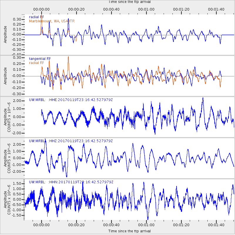
MRBL Marblemount, WA, USA - Earthquake Result Viewer
*The percent match for this event was below the threshold and hence no stack was calculated.
| Earthquake location: |
Solomon Islands |
| Earthquake latitude/longitude: |
-10.4/161.3 |
| Earthquake time(UTC): |
2017/01/19 (019) 23:04:20 GMT |
| Earthquake Depth: |
34 km |
| Earthquake Magnitude: |
6.8 mwp |
| Earthquake Catalog/Contributor: |
NEIC PDE/us |
|
| Network: |
UW Pacific Northwest Regional Seismic Network |
| Station: |
MRBL Marblemount, WA, USA |
| Lat/Lon: |
48.52 N/121.48 W |
| Elevation: |
75 m |
|
| Distance: |
89.4 deg |
| Az: |
40.428 deg |
| Baz: |
253.675 deg |
| Ray Param: |
$rayparam |
*The percent match for this event was below the threshold and hence was not used in the summary stack. |
|
| Radial Match: |
67.483025 % |
| Radial Bump: |
389 |
| Transverse Match: |
55.436447 % |
| Transverse Bump: |
400 |
| SOD ConfigId: |
11737051 |
| Insert Time: |
2019-04-26 16:16:36.011 +0000 |
| GWidth: |
2.5 |
| Max Bumps: |
400 |
| Tol: |
0.001 |
|
Signal To Noise
| Channel | StoN | STA | LTA |
| UW:MRBL: :HHZ:20170119T23:16:42.527979Z | 3.8285253 | 1.4593423E-6 | 3.811761E-7 |
| UW:MRBL: :HHN:20170119T23:16:42.527979Z | 1.0802053 | 6.410777E-7 | 5.9347764E-7 |
| UW:MRBL: :HHE:20170119T23:16:42.527979Z | 1.2673621 | 6.446772E-7 | 5.086764E-7 |
| Arrivals |
| Ps | |
| PpPs | |
| PsPs/PpSs | |


