You are here: Home > Network List > TA - USArray Transportable Network (new EarthScope stations) Stations List
> Station R32K Eaglecrest, AK, USA > Earthquake Result Viewer
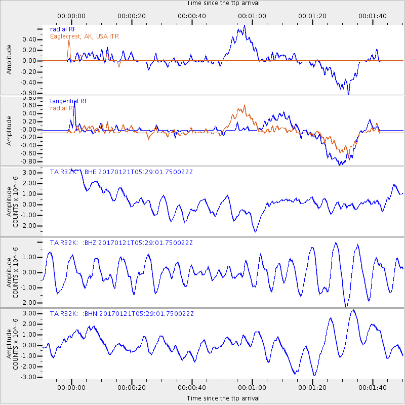
R32K Eaglecrest, AK, USA - Earthquake Result Viewer
*The percent match for this event was below the threshold and hence no stack was calculated.
| Earthquake location: |
Halmahera, Indonesia |
| Earthquake latitude/longitude: |
2.8/128.2 |
| Earthquake time(UTC): |
2017/01/21 (021) 05:16:33 GMT |
| Earthquake Depth: |
58 km |
| Earthquake Magnitude: |
5.7 mb |
| Earthquake Catalog/Contributor: |
NEIC PDE/us |
|
| Network: |
TA USArray Transportable Network (new EarthScope stations) |
| Station: |
R32K Eaglecrest, AK, USA |
| Lat/Lon: |
58.27 N/134.52 W |
| Elevation: |
386 m |
|
| Distance: |
91.5 deg |
| Az: |
31.621 deg |
| Baz: |
277.669 deg |
| Ray Param: |
$rayparam |
*The percent match for this event was below the threshold and hence was not used in the summary stack. |
|
| Radial Match: |
20.230455 % |
| Radial Bump: |
400 |
| Transverse Match: |
46.285305 % |
| Transverse Bump: |
400 |
| SOD ConfigId: |
11737051 |
| Insert Time: |
2019-04-26 16:35:18.164 +0000 |
| GWidth: |
2.5 |
| Max Bumps: |
400 |
| Tol: |
0.001 |
|
Signal To Noise
| Channel | StoN | STA | LTA |
| TA:R32K: :BHZ:20170121T05:29:01.750022Z | 1.3816454 | 6.972208E-7 | 5.0463075E-7 |
| TA:R32K: :BHN:20170121T05:29:01.750022Z | 3.663959 | 1.924555E-6 | 5.252665E-7 |
| TA:R32K: :BHE:20170121T05:29:01.750022Z | 1.8944148 | 1.8501548E-6 | 9.766367E-7 |
| Arrivals |
| Ps | |
| PpPs | |
| PsPs/PpSs | |


