You are here: Home > Network List > IU - Global Seismograph Network (GSN - IRIS/USGS) Stations List
> Station FURI Mt. Furi, Ethiopia > Earthquake Result Viewer
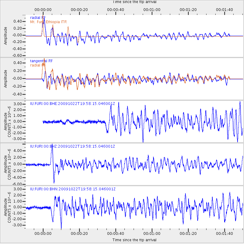
FURI Mt. Furi, Ethiopia - Earthquake Result Viewer
*The percent match for this event was below the threshold and hence no stack was calculated.
| Earthquake location: |
Hindu Kush Region, Afghanistan |
| Earthquake latitude/longitude: |
36.5/70.9 |
| Earthquake time(UTC): |
2009/10/22 (295) 19:51:27 GMT |
| Earthquake Depth: |
186 km |
| Earthquake Magnitude: |
6.1 MB, 6.2 MW, 6.1 MW |
| Earthquake Catalog/Contributor: |
WHDF/NEIC |
|
| Network: |
IU Global Seismograph Network (GSN - IRIS/USGS) |
| Station: |
FURI Mt. Furi, Ethiopia |
| Lat/Lon: |
8.90 N/38.68 E |
| Elevation: |
2570 m |
|
| Distance: |
40.2 deg |
| Az: |
234.865 deg |
| Baz: |
41.814 deg |
| Ray Param: |
$rayparam |
*The percent match for this event was below the threshold and hence was not used in the summary stack. |
|
| Radial Match: |
74.229774 % |
| Radial Bump: |
400 |
| Transverse Match: |
63.738567 % |
| Transverse Bump: |
400 |
| SOD ConfigId: |
1 |
| Insert Time: |
2010-02-19 00:53:37.964 +0000 |
| GWidth: |
2.5 |
| Max Bumps: |
400 |
| Tol: |
0.001 |
|
Signal To Noise
| Channel | StoN | STA | LTA |
| IU:FURI:00:BHZ:20091022T19:58:15.046001Z | 10.173842 | 1.2918124E-6 | 1.269739E-7 |
| IU:FURI:00:BHN:20091022T19:58:15.046001Z | 2.4046338 | 2.8137242E-7 | 1.170126E-7 |
| IU:FURI:00:BHE:20091022T19:58:15.046001Z | 1.4407272 | 2.1703373E-7 | 1.5064178E-7 |
| Arrivals |
| Ps | |
| PpPs | |
| PsPs/PpSs | |


