You are here: Home > Network List > TA - USArray Transportable Network (new EarthScope stations) Stations List
> Station G21K Allakaket, AK, USA > Earthquake Result Viewer
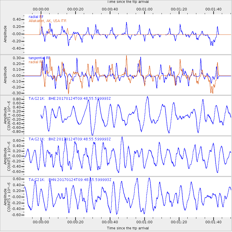
G21K Allakaket, AK, USA - Earthquake Result Viewer
*The percent match for this event was below the threshold and hence no stack was calculated.
| Earthquake location: |
South Of Mariana Islands |
| Earthquake latitude/longitude: |
12.1/146.3 |
| Earthquake time(UTC): |
2017/01/24 (024) 09:38:32 GMT |
| Earthquake Depth: |
19 km |
| Earthquake Magnitude: |
5.5 mb |
| Earthquake Catalog/Contributor: |
NEIC PDE/us |
|
| Network: |
TA USArray Transportable Network (new EarthScope stations) |
| Station: |
G21K Allakaket, AK, USA |
| Lat/Lon: |
66.52 N/153.51 W |
| Elevation: |
446 m |
|
| Distance: |
67.4 deg |
| Az: |
22.142 deg |
| Baz: |
246.923 deg |
| Ray Param: |
$rayparam |
*The percent match for this event was below the threshold and hence was not used in the summary stack. |
|
| Radial Match: |
41.973858 % |
| Radial Bump: |
269 |
| Transverse Match: |
50.227673 % |
| Transverse Bump: |
256 |
| SOD ConfigId: |
11737051 |
| Insert Time: |
2019-04-26 16:59:06.398 +0000 |
| GWidth: |
2.5 |
| Max Bumps: |
400 |
| Tol: |
0.001 |
|
Signal To Noise
| Channel | StoN | STA | LTA |
| TA:G21K: :BHZ:20170124T09:48:55.599993Z | 1.8011855 | 3.146422E-7 | 1.7468616E-7 |
| TA:G21K: :BHN:20170124T09:48:55.599993Z | 1.1248496 | 2.6018608E-7 | 2.3130744E-7 |
| TA:G21K: :BHE:20170124T09:48:55.599993Z | 2.1952467 | 6.3437807E-7 | 2.8897801E-7 |
| Arrivals |
| Ps | |
| PpPs | |
| PsPs/PpSs | |


