You are here: Home > Network List > TA - USArray Transportable Network (new EarthScope stations) Stations List
> Station MDND Maddock, ND, USA > Earthquake Result Viewer
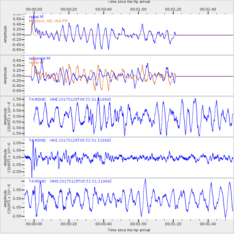
MDND Maddock, ND, USA - Earthquake Result Viewer
*The percent match for this event was below the threshold and hence no stack was calculated.
| Earthquake location: |
Near Coast Of Northern Peru |
| Earthquake latitude/longitude: |
-9.3/-78.9 |
| Earthquake time(UTC): |
2017/01/28 (028) 06:42:32 GMT |
| Earthquake Depth: |
46 km |
| Earthquake Magnitude: |
5.3 Mww |
| Earthquake Catalog/Contributor: |
NEIC PDE/us |
|
| Network: |
TA USArray Transportable Network (new EarthScope stations) |
| Station: |
MDND Maddock, ND, USA |
| Lat/Lon: |
47.85 N/99.60 W |
| Elevation: |
479 m |
|
| Distance: |
59.8 deg |
| Az: |
343.995 deg |
| Baz: |
156.171 deg |
| Ray Param: |
$rayparam |
*The percent match for this event was below the threshold and hence was not used in the summary stack. |
|
| Radial Match: |
38.3229 % |
| Radial Bump: |
303 |
| Transverse Match: |
63.087227 % |
| Transverse Bump: |
309 |
| SOD ConfigId: |
11737051 |
| Insert Time: |
2019-04-26 17:08:55.800 +0000 |
| GWidth: |
2.5 |
| Max Bumps: |
400 |
| Tol: |
0.001 |
|
Signal To Noise
| Channel | StoN | STA | LTA |
| TA:MDND: :HHZ:20170128T06:52:01.31999Z | 2.1908593 | 9.142341E-7 | 4.1729476E-7 |
| TA:MDND: :HHN:20170128T06:52:01.31999Z | 1.7988778 | 1.1555518E-6 | 6.4237366E-7 |
| TA:MDND: :HHE:20170128T06:52:01.31999Z | 1.1448987 | 7.260989E-7 | 6.342036E-7 |
| Arrivals |
| Ps | |
| PpPs | |
| PsPs/PpSs | |


