You are here: Home > Network List > TA - USArray Transportable Network (new EarthScope stations) Stations List
> Station P17K Kvichak River, AK, USA > Earthquake Result Viewer
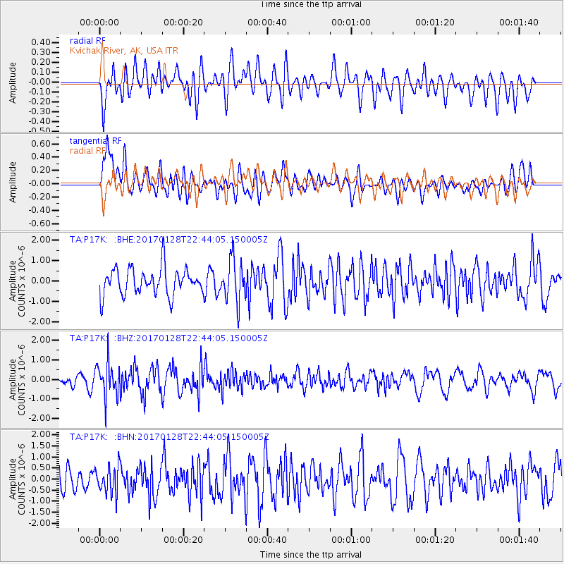
P17K Kvichak River, AK, USA - Earthquake Result Viewer
*The percent match for this event was below the threshold and hence no stack was calculated.
| Earthquake location: |
Samoa Islands Region |
| Earthquake latitude/longitude: |
-15.3/-173.0 |
| Earthquake time(UTC): |
2017/01/28 (028) 22:32:51 GMT |
| Earthquake Depth: |
10 km |
| Earthquake Magnitude: |
5.7 mb |
| Earthquake Catalog/Contributor: |
NEIC PDE/us |
|
| Network: |
TA USArray Transportable Network (new EarthScope stations) |
| Station: |
P17K Kvichak River, AK, USA |
| Lat/Lon: |
59.20 N/156.44 W |
| Elevation: |
91 m |
|
| Distance: |
75.5 deg |
| Az: |
8.702 deg |
| Baz: |
196.479 deg |
| Ray Param: |
$rayparam |
*The percent match for this event was below the threshold and hence was not used in the summary stack. |
|
| Radial Match: |
53.906086 % |
| Radial Bump: |
400 |
| Transverse Match: |
54.879543 % |
| Transverse Bump: |
400 |
| SOD ConfigId: |
11737051 |
| Insert Time: |
2019-04-26 17:19:35.564 +0000 |
| GWidth: |
2.5 |
| Max Bumps: |
400 |
| Tol: |
0.001 |
|
Signal To Noise
| Channel | StoN | STA | LTA |
| TA:P17K: :BHZ:20170128T22:44:05.150005Z | 2.6152465 | 8.810037E-7 | 3.3687212E-7 |
| TA:P17K: :BHN:20170128T22:44:05.150005Z | 1.0253192 | 6.214925E-7 | 6.0614536E-7 |
| TA:P17K: :BHE:20170128T22:44:05.150005Z | 1.5621029 | 1.0355922E-6 | 6.6294746E-7 |
| Arrivals |
| Ps | |
| PpPs | |
| PsPs/PpSs | |


