You are here: Home > Network List > TA - USArray Transportable Network (new EarthScope stations) Stations List
> Station M31M Drury Creek, Yukon, CA > Earthquake Result Viewer
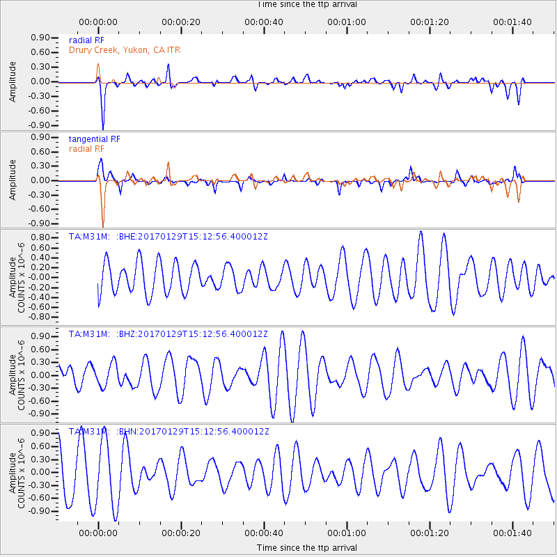
M31M Drury Creek, Yukon, CA - Earthquake Result Viewer
*The percent match for this event was below the threshold and hence no stack was calculated.
| Earthquake location: |
Kermadec Islands, New Zealand |
| Earthquake latitude/longitude: |
-30.1/-177.5 |
| Earthquake time(UTC): |
2017/01/29 (029) 14:59:51 GMT |
| Earthquake Depth: |
14 km |
| Earthquake Magnitude: |
5.7 Mwb |
| Earthquake Catalog/Contributor: |
NEIC PDE/us |
|
| Network: |
TA USArray Transportable Network (new EarthScope stations) |
| Station: |
M31M Drury Creek, Yukon, CA |
| Lat/Lon: |
62.20 N/134.39 W |
| Elevation: |
639 m |
|
| Distance: |
98.3 deg |
| Az: |
18.885 deg |
| Baz: |
216.748 deg |
| Ray Param: |
$rayparam |
*The percent match for this event was below the threshold and hence was not used in the summary stack. |
|
| Radial Match: |
66.877914 % |
| Radial Bump: |
400 |
| Transverse Match: |
70.43981 % |
| Transverse Bump: |
400 |
| SOD ConfigId: |
11737051 |
| Insert Time: |
2019-04-26 17:29:00.200 +0000 |
| GWidth: |
2.5 |
| Max Bumps: |
400 |
| Tol: |
0.001 |
|
Signal To Noise
| Channel | StoN | STA | LTA |
| TA:M31M: :BHZ:20170129T15:12:56.400012Z | 0.52865213 | 2.6202696E-7 | 4.95651E-7 |
| TA:M31M: :BHN:20170129T15:12:56.400012Z | 1.6350709 | 7.885671E-7 | 4.822831E-7 |
| TA:M31M: :BHE:20170129T15:12:56.400012Z | 0.77090555 | 2.3823944E-7 | 3.090384E-7 |
| Arrivals |
| Ps | |
| PpPs | |
| PsPs/PpSs | |


