You are here: Home > Network List > TA - USArray Transportable Network (new EarthScope stations) Stations List
> Station 121A Cookes Peak, Deming, NM, USA > Earthquake Result Viewer
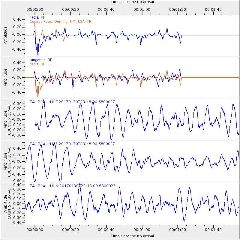
121A Cookes Peak, Deming, NM, USA - Earthquake Result Viewer
*The percent match for this event was below the threshold and hence no stack was calculated.
| Earthquake location: |
Vanuatu Islands |
| Earthquake latitude/longitude: |
-14.8/167.2 |
| Earthquake time(UTC): |
2017/01/30 (030) 23:35:23 GMT |
| Earthquake Depth: |
78 km |
| Earthquake Magnitude: |
5.8 Mwp |
| Earthquake Catalog/Contributor: |
NEIC PDE/us |
|
| Network: |
TA USArray Transportable Network (new EarthScope stations) |
| Station: |
121A Cookes Peak, Deming, NM, USA |
| Lat/Lon: |
32.53 N/107.79 W |
| Elevation: |
1652 m |
|
| Distance: |
93.8 deg |
| Az: |
57.499 deg |
| Baz: |
254.959 deg |
| Ray Param: |
$rayparam |
*The percent match for this event was below the threshold and hence was not used in the summary stack. |
|
| Radial Match: |
80.88923 % |
| Radial Bump: |
400 |
| Transverse Match: |
57.82097 % |
| Transverse Bump: |
400 |
| SOD ConfigId: |
11737051 |
| Insert Time: |
2019-04-26 17:41:06.697 +0000 |
| GWidth: |
2.5 |
| Max Bumps: |
400 |
| Tol: |
0.001 |
|
Signal To Noise
| Channel | StoN | STA | LTA |
| TA:121A: :HHZ:20170130T23:48:00.680002Z | 2.2497404 | 4.1354443E-7 | 1.8381873E-7 |
| TA:121A: :HHN:20170130T23:48:00.680002Z | 0.5825127 | 7.0271405E-8 | 1.20635E-7 |
| TA:121A: :HHE:20170130T23:48:00.680002Z | 1.6289165 | 2.1533575E-7 | 1.321957E-7 |
| Arrivals |
| Ps | |
| PpPs | |
| PsPs/PpSs | |


