You are here: Home > Network List > UW - Pacific Northwest Regional Seismic Network Stations List
> Station UMAT Pilot Rock, OR, USA > Earthquake Result Viewer
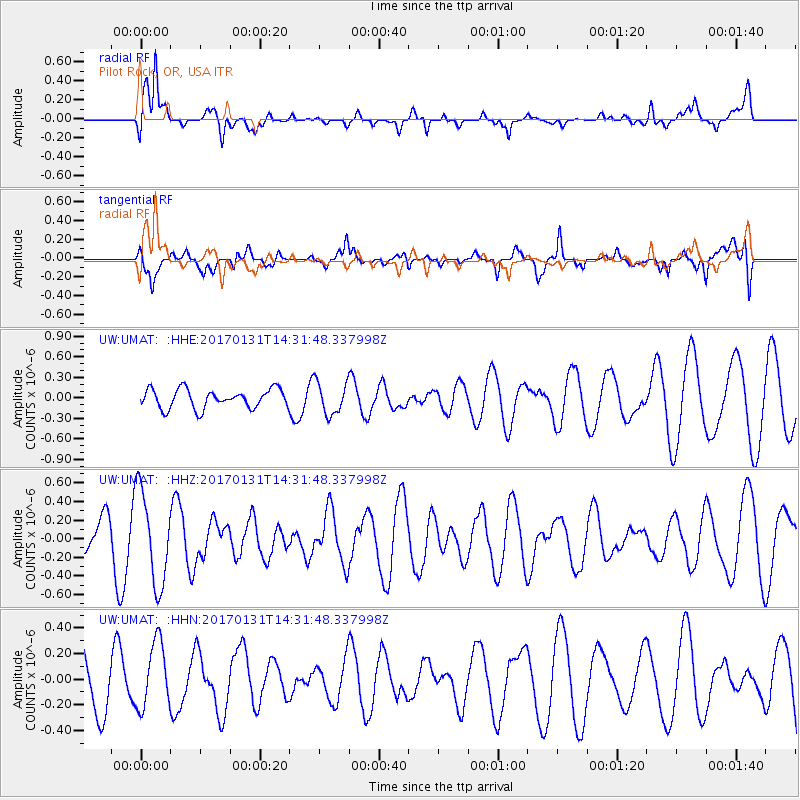
UMAT Pilot Rock, OR, USA - Earthquake Result Viewer
*The percent match for this event was below the threshold and hence no stack was calculated.
| Earthquake location: |
Near Coast Of Ecuador |
| Earthquake latitude/longitude: |
0.7/-79.7 |
| Earthquake time(UTC): |
2017/01/31 (031) 14:22:40 GMT |
| Earthquake Depth: |
21 km |
| Earthquake Magnitude: |
5.5 Mww |
| Earthquake Catalog/Contributor: |
NEIC PDE/us |
|
| Network: |
UW Pacific Northwest Regional Seismic Network |
| Station: |
UMAT Pilot Rock, OR, USA |
| Lat/Lon: |
45.29 N/118.96 W |
| Elevation: |
1318 m |
|
| Distance: |
56.3 deg |
| Az: |
327.502 deg |
| Baz: |
130.442 deg |
| Ray Param: |
$rayparam |
*The percent match for this event was below the threshold and hence was not used in the summary stack. |
|
| Radial Match: |
63.849136 % |
| Radial Bump: |
400 |
| Transverse Match: |
54.43307 % |
| Transverse Bump: |
400 |
| SOD ConfigId: |
11737051 |
| Insert Time: |
2019-04-26 17:51:16.204 +0000 |
| GWidth: |
2.5 |
| Max Bumps: |
400 |
| Tol: |
0.001 |
|
Signal To Noise
| Channel | StoN | STA | LTA |
| UW:UMAT: :HHZ:20170131T14:31:48.337998Z | 3.2084649 | 4.9849706E-7 | 1.5536934E-7 |
| UW:UMAT: :HHN:20170131T14:31:48.337998Z | 0.9174219 | 2.562938E-7 | 2.7936306E-7 |
| UW:UMAT: :HHE:20170131T14:31:48.337998Z | 1.6954492 | 2.3552074E-7 | 1.3891346E-7 |
| Arrivals |
| Ps | |
| PpPs | |
| PsPs/PpSs | |


