You are here: Home > Network List > CI - Caltech Regional Seismic Network Stations List
> Station GLA Glamis, Glamis, CA, USA > Earthquake Result Viewer
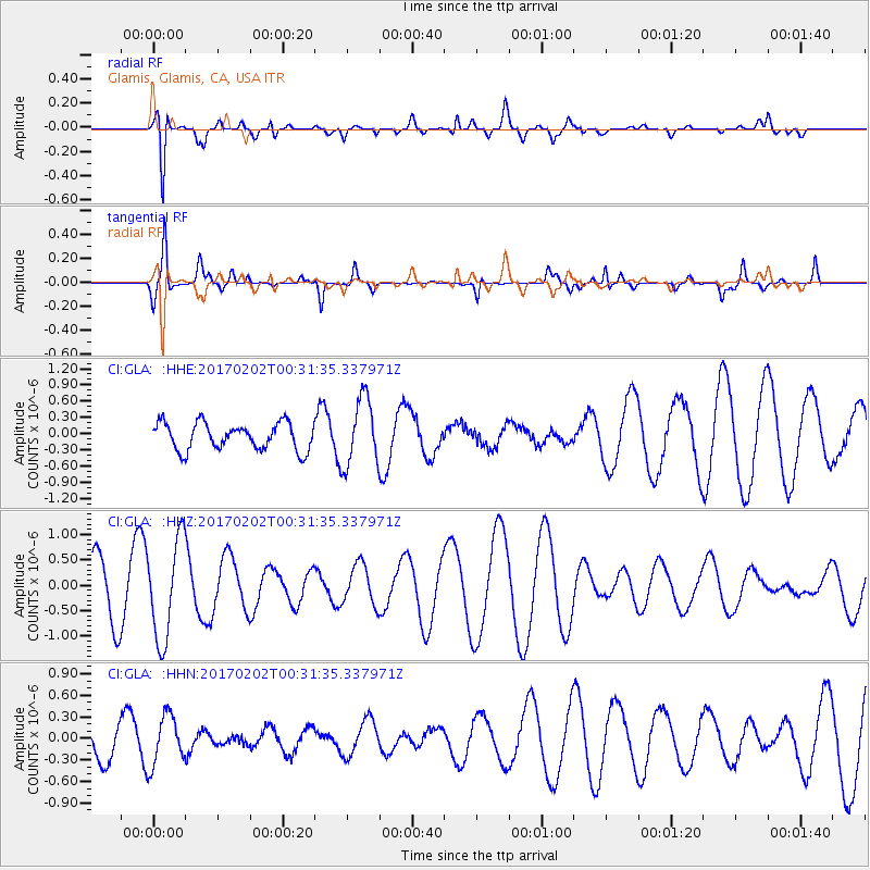
GLA Glamis, Glamis, CA, USA - Earthquake Result Viewer
*The percent match for this event was below the threshold and hence no stack was calculated.
| Earthquake location: |
South Of Mariana Islands |
| Earthquake latitude/longitude: |
12.1/141.0 |
| Earthquake time(UTC): |
2017/02/02 (033) 00:18:43 GMT |
| Earthquake Depth: |
9.0 km |
| Earthquake Magnitude: |
5.6 Mww |
| Earthquake Catalog/Contributor: |
NEIC PDE/us |
|
| Network: |
CI Caltech Regional Seismic Network |
| Station: |
GLA Glamis, Glamis, CA, USA |
| Lat/Lon: |
33.05 N/114.83 W |
| Elevation: |
610 m |
|
| Distance: |
95.0 deg |
| Az: |
54.835 deg |
| Baz: |
287.816 deg |
| Ray Param: |
$rayparam |
*The percent match for this event was below the threshold and hence was not used in the summary stack. |
|
| Radial Match: |
79.42992 % |
| Radial Bump: |
356 |
| Transverse Match: |
75.249405 % |
| Transverse Bump: |
288 |
| SOD ConfigId: |
11737051 |
| Insert Time: |
2019-04-26 17:55:35.844 +0000 |
| GWidth: |
2.5 |
| Max Bumps: |
400 |
| Tol: |
0.001 |
|
Signal To Noise
| Channel | StoN | STA | LTA |
| CI:GLA: :HHZ:20170202T00:31:35.337971Z | 1.9499741 | 9.850777E-7 | 5.051748E-7 |
| CI:GLA: :HHN:20170202T00:31:35.337971Z | 1.6114184 | 3.4703604E-7 | 2.153606E-7 |
| CI:GLA: :HHE:20170202T00:31:35.337971Z | 2.4888043 | 6.2369793E-7 | 2.5060143E-7 |
| Arrivals |
| Ps | |
| PpPs | |
| PsPs/PpSs | |


