You are here: Home > Network List > US - United States National Seismic Network Stations List
> Station TPNV Topopah Spring, Nevada, USA > Earthquake Result Viewer
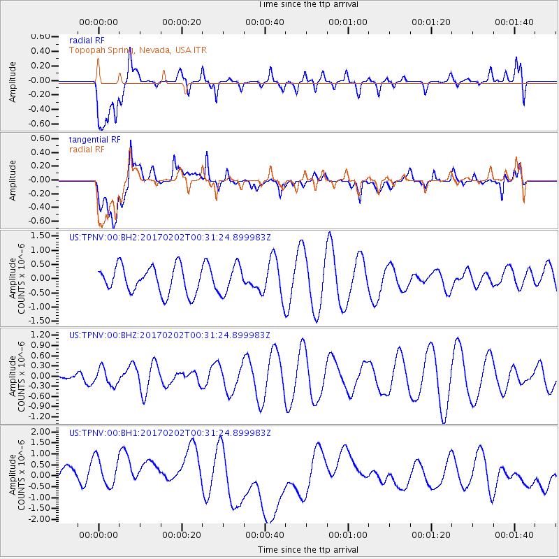
TPNV Topopah Spring, Nevada, USA - Earthquake Result Viewer
*The percent match for this event was below the threshold and hence no stack was calculated.
| Earthquake location: |
South Of Mariana Islands |
| Earthquake latitude/longitude: |
12.1/141.0 |
| Earthquake time(UTC): |
2017/02/02 (033) 00:18:43 GMT |
| Earthquake Depth: |
9.0 km |
| Earthquake Magnitude: |
5.6 Mww |
| Earthquake Catalog/Contributor: |
NEIC PDE/us |
|
| Network: |
US United States National Seismic Network |
| Station: |
TPNV Topopah Spring, Nevada, USA |
| Lat/Lon: |
36.95 N/116.25 W |
| Elevation: |
1600 m |
|
| Distance: |
92.8 deg |
| Az: |
51.472 deg |
| Baz: |
287.232 deg |
| Ray Param: |
$rayparam |
*The percent match for this event was below the threshold and hence was not used in the summary stack. |
|
| Radial Match: |
26.494284 % |
| Radial Bump: |
400 |
| Transverse Match: |
27.593826 % |
| Transverse Bump: |
400 |
| SOD ConfigId: |
11737051 |
| Insert Time: |
2019-04-26 17:58:45.403 +0000 |
| GWidth: |
2.5 |
| Max Bumps: |
400 |
| Tol: |
0.001 |
|
Signal To Noise
| Channel | StoN | STA | LTA |
| US:TPNV:00:BHZ:20170202T00:31:24.899983Z | 1.597249 | 2.539964E-7 | 1.5902117E-7 |
| US:TPNV:00:BH1:20170202T00:31:24.899983Z | 1.3631012 | 8.9056755E-7 | 6.533392E-7 |
| US:TPNV:00:BH2:20170202T00:31:24.899983Z | 1.0719457 | 5.002318E-7 | 4.666578E-7 |
| Arrivals |
| Ps | |
| PpPs | |
| PsPs/PpSs | |


