You are here: Home > Network List > AZ - ANZA Regional Network Stations List
> Station SMER AZ.SMER > Earthquake Result Viewer
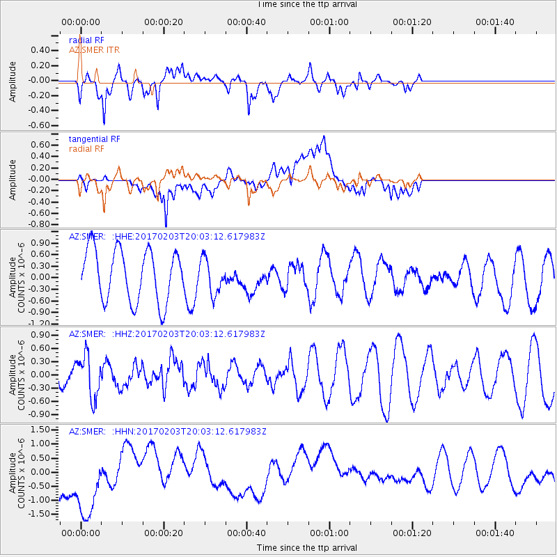
SMER AZ.SMER - Earthquake Result Viewer
*The percent match for this event was below the threshold and hence no stack was calculated.
| Earthquake location: |
Leeward Islands |
| Earthquake latitude/longitude: |
15.1/-60.5 |
| Earthquake time(UTC): |
2017/02/03 (034) 19:54:21 GMT |
| Earthquake Depth: |
35 km |
| Earthquake Magnitude: |
5.6 Mwb |
| Earthquake Catalog/Contributor: |
NEIC PDE/us |
|
| Network: |
AZ ANZA Regional Network |
| Station: |
SMER AZ.SMER |
| Lat/Lon: |
33.46 N/117.17 W |
| Elevation: |
355 m |
|
| Distance: |
54.1 deg |
| Az: |
300.487 deg |
| Baz: |
95.309 deg |
| Ray Param: |
$rayparam |
*The percent match for this event was below the threshold and hence was not used in the summary stack. |
|
| Radial Match: |
75.50256 % |
| Radial Bump: |
400 |
| Transverse Match: |
33.49243 % |
| Transverse Bump: |
400 |
| SOD ConfigId: |
11737051 |
| Insert Time: |
2019-04-26 18:01:23.364 +0000 |
| GWidth: |
2.5 |
| Max Bumps: |
400 |
| Tol: |
0.001 |
|
Signal To Noise
| Channel | StoN | STA | LTA |
| AZ:SMER: :HHZ:20170203T20:03:12.617983Z | 1.6580178 | 4.909974E-7 | 2.961352E-7 |
| AZ:SMER: :HHN:20170203T20:03:12.617983Z | 1.8702587 | 1.6107251E-6 | 8.612312E-7 |
| AZ:SMER: :HHE:20170203T20:03:12.617983Z | 0.67086387 | 4.4832638E-7 | 6.6828215E-7 |
| Arrivals |
| Ps | |
| PpPs | |
| PsPs/PpSs | |


