You are here: Home > Network List > CI - Caltech Regional Seismic Network Stations List
> Station FMP Fort MacArthur Park, Pt. Fermin San Pedro, CA, USA > Earthquake Result Viewer
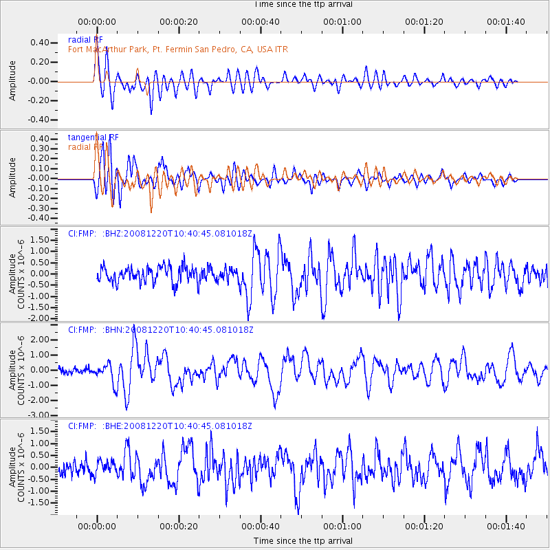
FMP Fort MacArthur Park, Pt. Fermin San Pedro, CA, USA - Earthquake Result Viewer
*The percent match for this event was below the threshold and hence no stack was calculated.
| Earthquake location: |
Off East Coast Of Honshu, Japan |
| Earthquake latitude/longitude: |
36.5/142.4 |
| Earthquake time(UTC): |
2008/12/20 (355) 10:29:23 GMT |
| Earthquake Depth: |
19 km |
| Earthquake Magnitude: |
6.0 MB, 6.3 MS, 6.3 MW, 6.3 MW |
| Earthquake Catalog/Contributor: |
WHDF/NEIC |
|
| Network: |
CI Caltech Regional Seismic Network |
| Station: |
FMP Fort MacArthur Park, Pt. Fermin San Pedro, CA, USA |
| Lat/Lon: |
33.71 N/118.29 W |
| Elevation: |
89 m |
|
| Distance: |
77.3 deg |
| Az: |
57.474 deg |
| Baz: |
305.451 deg |
| Ray Param: |
$rayparam |
*The percent match for this event was below the threshold and hence was not used in the summary stack. |
|
| Radial Match: |
75.2767 % |
| Radial Bump: |
400 |
| Transverse Match: |
76.20043 % |
| Transverse Bump: |
400 |
| SOD ConfigId: |
2658 |
| Insert Time: |
2010-03-05 21:54:48.288 +0000 |
| GWidth: |
2.5 |
| Max Bumps: |
400 |
| Tol: |
0.001 |
|
Signal To Noise
| Channel | StoN | STA | LTA |
| CI:FMP: :BHN:20081220T10:40:45.081018Z | 3.5204978 | 6.569823E-7 | 1.866163E-7 |
| CI:FMP: :BHE:20081220T10:40:45.081018Z | 0.98245555 | 2.6760867E-7 | 2.7238758E-7 |
| CI:FMP: :BHZ:20081220T10:40:45.081018Z | 0.7086126 | 2.460162E-7 | 3.471801E-7 |
| Arrivals |
| Ps | |
| PpPs | |
| PsPs/PpSs | |


