You are here: Home > Network List > TA - USArray Transportable Network (new EarthScope stations) Stations List
> Station A21K Barrow, AK, USA > Earthquake Result Viewer
A21K Barrow, AK, USA - Earthquake Result Viewer
*The percent match for this event was below the threshold and hence no stack was calculated.
| Earthquake location: |
Leeward Islands |
| Earthquake latitude/longitude: |
15.1/-60.5 |
| Earthquake time(UTC): |
2017/02/03 (034) 19:54:21 GMT |
| Earthquake Depth: |
35 km |
| Earthquake Magnitude: |
5.6 Mwb |
| Earthquake Catalog/Contributor: |
NEIC PDE/us |
|
| Network: |
TA USArray Transportable Network (new EarthScope stations) |
| Station: |
A21K Barrow, AK, USA |
| Lat/Lon: |
71.32 N/156.62 W |
| Elevation: |
577 m |
|
| Distance: |
77.8 deg |
| Az: |
340.866 deg |
| Baz: |
79.343 deg |
| Ray Param: |
$rayparam |
*The percent match for this event was below the threshold and hence was not used in the summary stack. |
|
| Radial Match: |
54.761215 % |
| Radial Bump: |
400 |
| Transverse Match: |
58.244095 % |
| Transverse Bump: |
400 |
| SOD ConfigId: |
11737051 |
| Insert Time: |
2019-04-26 18:07:11.220 +0000 |
| GWidth: |
2.5 |
| Max Bumps: |
400 |
| Tol: |
0.001 |
|
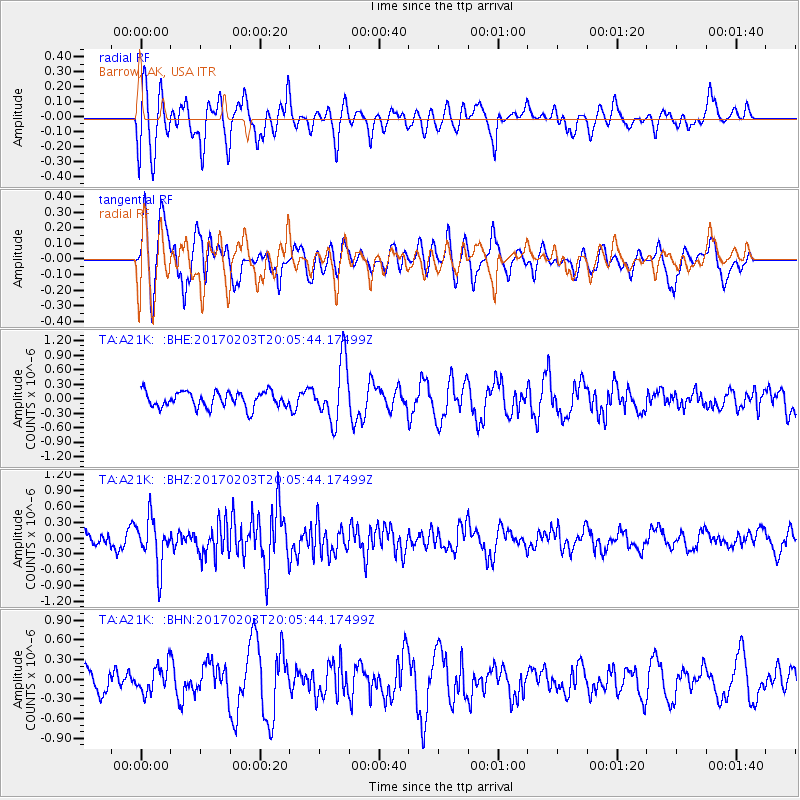
Signal To Noise
| Channel | StoN | STA | LTA |
| TA:A21K: :BHZ:20170203T20:05:44.17499Z | 2.6839886 | 4.5340795E-7 | 1.6893065E-7 |
| TA:A21K: :BHN:20170203T20:05:44.17499Z | 0.84399486 | 2.0456282E-7 | 2.423745E-7 |
| TA:A21K: :BHE:20170203T20:05:44.17499Z | 3.7985349 | 6.147622E-7 | 1.6184192E-7 |
| Arrivals |
| Ps | |
| PpPs | |
| PsPs/PpSs | |


