You are here: Home > Network List > TA - USArray Transportable Network (new EarthScope stations) Stations List
> Station 435B Jarrell, TX, USA > Earthquake Result Viewer
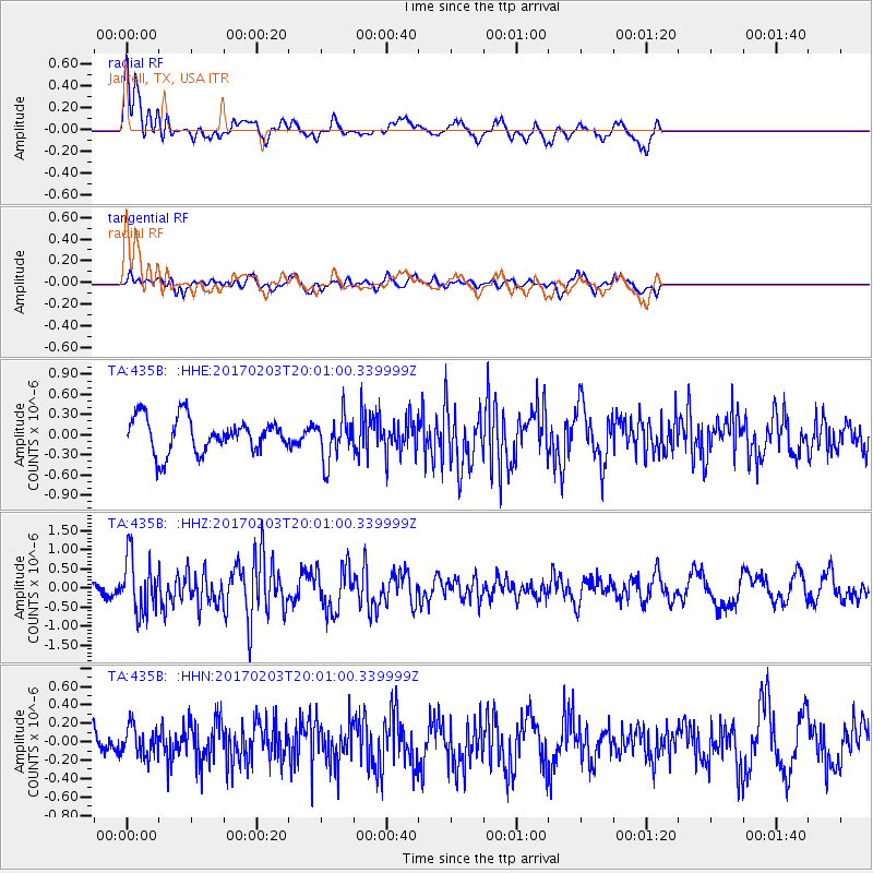
435B Jarrell, TX, USA - Earthquake Result Viewer
*The percent match for this event was below the threshold and hence no stack was calculated.
| Earthquake location: |
Leeward Islands |
| Earthquake latitude/longitude: |
15.1/-60.5 |
| Earthquake time(UTC): |
2017/02/03 (034) 19:54:21 GMT |
| Earthquake Depth: |
35 km |
| Earthquake Magnitude: |
5.6 Mwb |
| Earthquake Catalog/Contributor: |
NEIC PDE/us |
|
| Network: |
TA USArray Transportable Network (new EarthScope stations) |
| Station: |
435B Jarrell, TX, USA |
| Lat/Lon: |
30.78 N/97.58 W |
| Elevation: |
248 m |
|
| Distance: |
37.3 deg |
| Az: |
301.202 deg |
| Baz: |
106.252 deg |
| Ray Param: |
$rayparam |
*The percent match for this event was below the threshold and hence was not used in the summary stack. |
|
| Radial Match: |
77.02323 % |
| Radial Bump: |
372 |
| Transverse Match: |
57.821796 % |
| Transverse Bump: |
400 |
| SOD ConfigId: |
11737051 |
| Insert Time: |
2019-04-26 18:07:13.651 +0000 |
| GWidth: |
2.5 |
| Max Bumps: |
400 |
| Tol: |
0.001 |
|
Signal To Noise
| Channel | StoN | STA | LTA |
| TA:435B: :HHZ:20170203T20:01:00.339999Z | 3.2729118 | 7.183096E-7 | 2.1947112E-7 |
| TA:435B: :HHN:20170203T20:01:00.339999Z | 1.070643 | 1.6373926E-7 | 1.5293546E-7 |
| TA:435B: :HHE:20170203T20:01:00.339999Z | 1.2806178 | 3.268548E-7 | 2.5523212E-7 |
| Arrivals |
| Ps | |
| PpPs | |
| PsPs/PpSs | |


