You are here: Home > Network List > TA - USArray Transportable Network (new EarthScope stations) Stations List
> Station D25K Kavik River, AK, USA > Earthquake Result Viewer
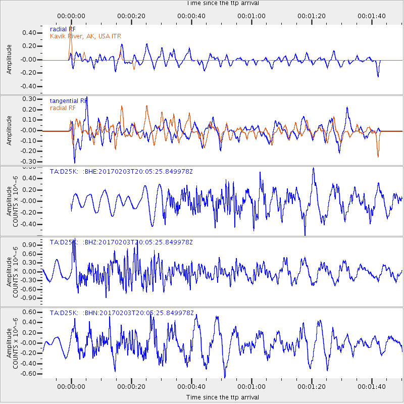
D25K Kavik River, AK, USA - Earthquake Result Viewer
*The percent match for this event was below the threshold and hence no stack was calculated.
| Earthquake location: |
Leeward Islands |
| Earthquake latitude/longitude: |
15.1/-60.5 |
| Earthquake time(UTC): |
2017/02/03 (034) 19:54:21 GMT |
| Earthquake Depth: |
35 km |
| Earthquake Magnitude: |
5.6 Mwb |
| Earthquake Catalog/Contributor: |
NEIC PDE/us |
|
| Network: |
TA USArray Transportable Network (new EarthScope stations) |
| Station: |
D25K Kavik River, AK, USA |
| Lat/Lon: |
69.32 N/146.38 W |
| Elevation: |
770 m |
|
| Distance: |
74.5 deg |
| Az: |
338.434 deg |
| Baz: |
88.402 deg |
| Ray Param: |
$rayparam |
*The percent match for this event was below the threshold and hence was not used in the summary stack. |
|
| Radial Match: |
62.864304 % |
| Radial Bump: |
400 |
| Transverse Match: |
60.37826 % |
| Transverse Bump: |
400 |
| SOD ConfigId: |
11737051 |
| Insert Time: |
2019-04-26 18:07:17.439 +0000 |
| GWidth: |
2.5 |
| Max Bumps: |
400 |
| Tol: |
0.001 |
|
Signal To Noise
| Channel | StoN | STA | LTA |
| TA:D25K: :BHZ:20170203T20:05:25.849978Z | 3.081305 | 4.5971072E-7 | 1.4919351E-7 |
| TA:D25K: :BHN:20170203T20:05:25.849978Z | 1.4177724 | 2.0512381E-7 | 1.4468034E-7 |
| TA:D25K: :BHE:20170203T20:05:25.849978Z | 1.4757956 | 1.8150395E-7 | 1.2298719E-7 |
| Arrivals |
| Ps | |
| PpPs | |
| PsPs/PpSs | |


