You are here: Home > Network List > TA - USArray Transportable Network (new EarthScope stations) Stations List
> Station F26K Sheenjek River, AK, USA > Earthquake Result Viewer
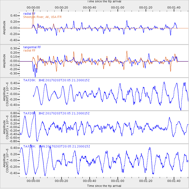
F26K Sheenjek River, AK, USA - Earthquake Result Viewer
*The percent match for this event was below the threshold and hence no stack was calculated.
| Earthquake location: |
Leeward Islands |
| Earthquake latitude/longitude: |
15.1/-60.5 |
| Earthquake time(UTC): |
2017/02/03 (034) 19:54:21 GMT |
| Earthquake Depth: |
35 km |
| Earthquake Magnitude: |
5.6 Mwb |
| Earthquake Catalog/Contributor: |
NEIC PDE/us |
|
| Network: |
TA USArray Transportable Network (new EarthScope stations) |
| Station: |
F26K Sheenjek River, AK, USA |
| Lat/Lon: |
67.69 N/144.15 W |
| Elevation: |
683 m |
|
| Distance: |
73.7 deg |
| Az: |
336.723 deg |
| Baz: |
90.007 deg |
| Ray Param: |
$rayparam |
*The percent match for this event was below the threshold and hence was not used in the summary stack. |
|
| Radial Match: |
62.90819 % |
| Radial Bump: |
365 |
| Transverse Match: |
53.622364 % |
| Transverse Bump: |
400 |
| SOD ConfigId: |
11737051 |
| Insert Time: |
2019-04-26 18:07:19.102 +0000 |
| GWidth: |
2.5 |
| Max Bumps: |
400 |
| Tol: |
0.001 |
|
Signal To Noise
| Channel | StoN | STA | LTA |
| TA:F26K: :BHZ:20170203T20:05:21.200015Z | 2.3685346 | 5.822633E-7 | 2.4583272E-7 |
| TA:F26K: :BHN:20170203T20:05:21.200015Z | 1.2423376 | 2.7583178E-7 | 2.2202643E-7 |
| TA:F26K: :BHE:20170203T20:05:21.200015Z | 0.48787066 | 1.0048716E-7 | 2.059709E-7 |
| Arrivals |
| Ps | |
| PpPs | |
| PsPs/PpSs | |


