You are here: Home > Network List > TA - USArray Transportable Network (new EarthScope stations) Stations List
> Station MDND Maddock, ND, USA > Earthquake Result Viewer
MDND Maddock, ND, USA - Earthquake Result Viewer
*The percent match for this event was below the threshold and hence no stack was calculated.
| Earthquake location: |
Leeward Islands |
| Earthquake latitude/longitude: |
15.1/-60.5 |
| Earthquake time(UTC): |
2017/02/03 (034) 19:54:21 GMT |
| Earthquake Depth: |
35 km |
| Earthquake Magnitude: |
5.6 Mwb |
| Earthquake Catalog/Contributor: |
NEIC PDE/us |
|
| Network: |
TA USArray Transportable Network (new EarthScope stations) |
| Station: |
MDND Maddock, ND, USA |
| Lat/Lon: |
47.85 N/99.60 W |
| Elevation: |
479 m |
|
| Distance: |
45.9 deg |
| Az: |
323.72 deg |
| Baz: |
121.942 deg |
| Ray Param: |
$rayparam |
*The percent match for this event was below the threshold and hence was not used in the summary stack. |
|
| Radial Match: |
53.907646 % |
| Radial Bump: |
338 |
| Transverse Match: |
46.800846 % |
| Transverse Bump: |
378 |
| SOD ConfigId: |
11737051 |
| Insert Time: |
2019-04-26 18:07:32.435 +0000 |
| GWidth: |
2.5 |
| Max Bumps: |
400 |
| Tol: |
0.001 |
|
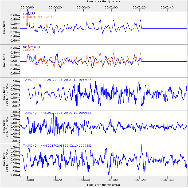
Signal To Noise
| Channel | StoN | STA | LTA |
| TA:MDND: :HHZ:20170203T20:02:10.109988Z | 3.4231322 | 7.010922E-7 | 2.0481015E-7 |
| TA:MDND: :HHN:20170203T20:02:10.109988Z | 2.5052066 | 8.625123E-7 | 3.442879E-7 |
| TA:MDND: :HHE:20170203T20:02:10.109988Z | 1.1248395 | 5.848953E-7 | 5.199811E-7 |
| Arrivals |
| Ps | |
| PpPs | |
| PsPs/PpSs | |


