You are here: Home > Network List > TA - USArray Transportable Network (new EarthScope stations) Stations List
> Station O18K Koktuh Hills, AK, USA > Earthquake Result Viewer
O18K Koktuh Hills, AK, USA - Earthquake Result Viewer
*The percent match for this event was below the threshold and hence no stack was calculated.
| Earthquake location: |
Leeward Islands |
| Earthquake latitude/longitude: |
15.1/-60.5 |
| Earthquake time(UTC): |
2017/02/03 (034) 19:54:21 GMT |
| Earthquake Depth: |
35 km |
| Earthquake Magnitude: |
5.6 Mwb |
| Earthquake Catalog/Contributor: |
NEIC PDE/us |
|
| Network: |
TA USArray Transportable Network (new EarthScope stations) |
| Station: |
O18K Koktuh Hills, AK, USA |
| Lat/Lon: |
59.85 N/155.21 W |
| Elevation: |
544 m |
|
| Distance: |
79.4 deg |
| Az: |
329.223 deg |
| Baz: |
78.323 deg |
| Ray Param: |
$rayparam |
*The percent match for this event was below the threshold and hence was not used in the summary stack. |
|
| Radial Match: |
70.75941 % |
| Radial Bump: |
400 |
| Transverse Match: |
61.469685 % |
| Transverse Bump: |
378 |
| SOD ConfigId: |
11737051 |
| Insert Time: |
2019-04-26 18:07:38.680 +0000 |
| GWidth: |
2.5 |
| Max Bumps: |
400 |
| Tol: |
0.001 |
|
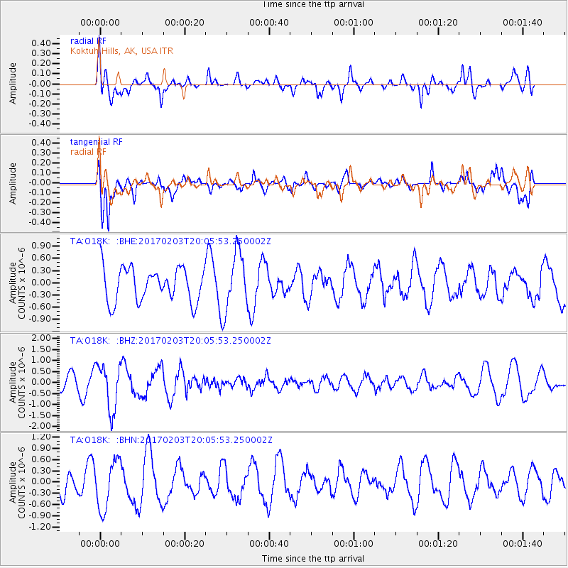
Signal To Noise
| Channel | StoN | STA | LTA |
| TA:O18K: :BHZ:20170203T20:05:53.250002Z | 3.3192983 | 1.0414136E-6 | 3.1374512E-7 |
| TA:O18K: :BHN:20170203T20:05:53.250002Z | 1.677452 | 6.649326E-7 | 3.9639443E-7 |
| TA:O18K: :BHE:20170203T20:05:53.250002Z | 1.6939026 | 6.9236796E-7 | 4.087413E-7 |
| Arrivals |
| Ps | |
| PpPs | |
| PsPs/PpSs | |


