You are here: Home > Network List > UW - Pacific Northwest Regional Seismic Network Stations List
> Station LEBA Lebam, WA, USA > Earthquake Result Viewer
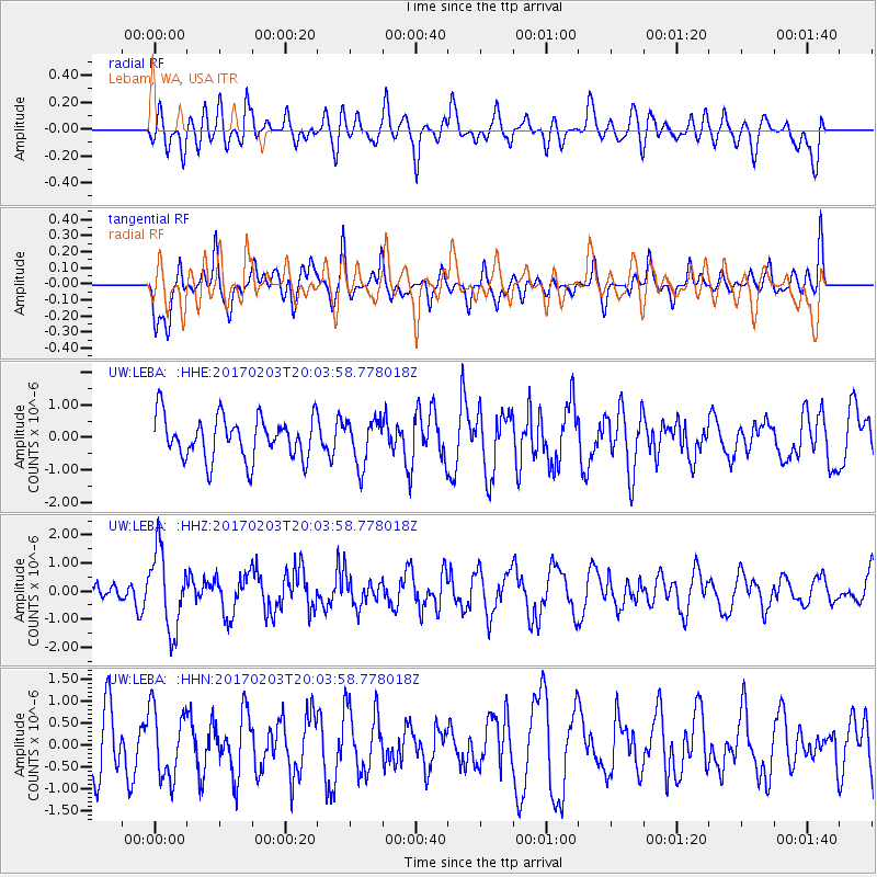
LEBA Lebam, WA, USA - Earthquake Result Viewer
*The percent match for this event was below the threshold and hence no stack was calculated.
| Earthquake location: |
Leeward Islands |
| Earthquake latitude/longitude: |
15.1/-60.5 |
| Earthquake time(UTC): |
2017/02/03 (034) 19:54:21 GMT |
| Earthquake Depth: |
35 km |
| Earthquake Magnitude: |
5.6 Mwb |
| Earthquake Catalog/Contributor: |
NEIC PDE/us |
|
| Network: |
UW Pacific Northwest Regional Seismic Network |
| Station: |
LEBA Lebam, WA, USA |
| Lat/Lon: |
46.55 N/123.56 W |
| Elevation: |
73 m |
|
| Distance: |
60.7 deg |
| Az: |
315.129 deg |
| Baz: |
99.112 deg |
| Ray Param: |
$rayparam |
*The percent match for this event was below the threshold and hence was not used in the summary stack. |
|
| Radial Match: |
59.662537 % |
| Radial Bump: |
400 |
| Transverse Match: |
55.65803 % |
| Transverse Bump: |
400 |
| SOD ConfigId: |
11737051 |
| Insert Time: |
2019-04-26 18:08:23.649 +0000 |
| GWidth: |
2.5 |
| Max Bumps: |
400 |
| Tol: |
0.001 |
|
Signal To Noise
| Channel | StoN | STA | LTA |
| UW:LEBA: :HHZ:20170203T20:03:58.778018Z | 3.2713306 | 1.3834816E-6 | 4.2291097E-7 |
| UW:LEBA: :HHN:20170203T20:03:58.778018Z | 1.2024345 | 7.9602427E-7 | 6.620105E-7 |
| UW:LEBA: :HHE:20170203T20:03:58.778018Z | 1.065877 | 6.9589174E-7 | 6.5288185E-7 |
| Arrivals |
| Ps | |
| PpPs | |
| PsPs/PpSs | |


