GMR Granite Mountains Research Center - Earthquake Result Viewer
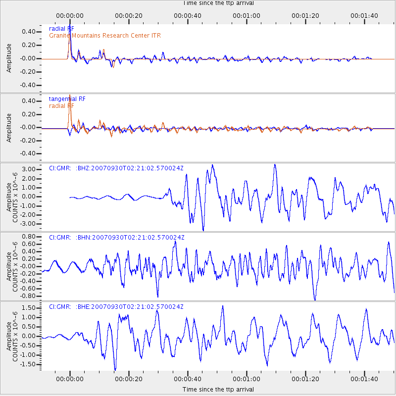
Earthquake location: South Of Mariana Islands
Earthquake latitude/longitude: 10.5/145.7
Earthquake time(UTC): 2007/09/30 (273) 02:08:30 GMT
Earthquake Depth: 14 km
Earthquake Magnitude: 6.4 MB, 7.1 MS, 6.9 MW, 6.9 MW
Earthquake Catalog/Contributor: WHDF/NEIC
Network: CI Caltech Regional Seismic Network
Station: GMR Granite Mountains Research Center
Lat/Lon: 34.78 N/115.66 W
Elevation: 1326 m
Distance: 91.1 deg
Az: 54.482 deg
Baz: 283.425 deg
Ray Param: 0.04162634
Estimated Moho Depth: 27.0 km
Estimated Crust Vp/Vs: 1.69
Assumed Crust Vp: 6.276 km/s
Estimated Crust Vs: 3.719 km/s
Estimated Crust Poisson's Ratio: 0.23
Radial Match: 96.508736 %
Radial Bump: 322
Transverse Match: 75.516716 %
Transverse Bump: 400
SOD ConfigId: 2564
Insert Time: 2010-03-05 21:55:55.746 +0000
GWidth: 2.5
Max Bumps: 400
Tol: 0.001

Signal To Noise

ChannelStoNSTALTA
CI:GMR: :BHN:20070930T02:21:02.570024Z0.67094329.627256E-81.4348839E-7
CI:GMR: :BHE:20070930T02:21:02.570024Z2.16418121.5174474E-77.011647E-8
CI:GMR: :BHZ:20070930T02:21:02.570024Z2.49046953.8413543E-71.5424219E-7
Arrivals
Ps3.0 SECOND
PpPs11 SECOND
PsPs/PpSs14 SECOND