You are here: Home > Network List > IU - Global Seismograph Network (GSN - IRIS/USGS) Stations List
> Station RSSD Black Hills, South Dakota, USA > Earthquake Result Viewer
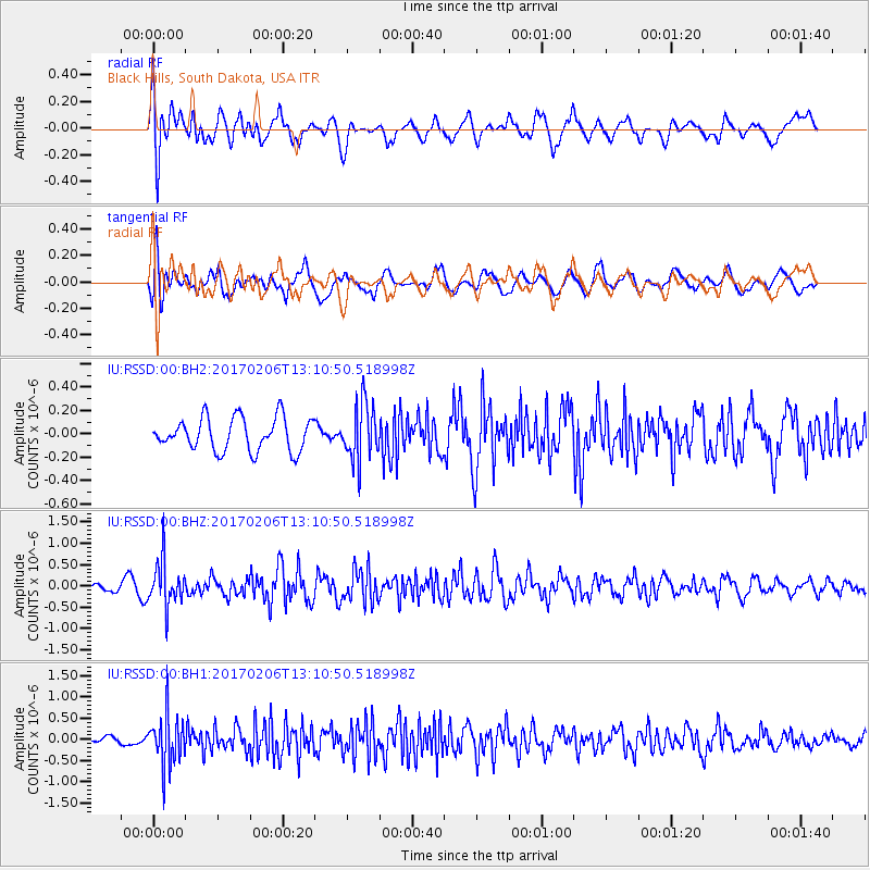
RSSD Black Hills, South Dakota, USA - Earthquake Result Viewer
*The percent match for this event was below the threshold and hence no stack was calculated.
| Earthquake location: |
Colombia |
| Earthquake latitude/longitude: |
3.4/-74.7 |
| Earthquake time(UTC): |
2017/02/06 (037) 13:02:45 GMT |
| Earthquake Depth: |
38 km |
| Earthquake Magnitude: |
5.5 Mww |
| Earthquake Catalog/Contributor: |
NEIC PDE/us |
|
| Network: |
IU Global Seismograph Network (GSN - IRIS/USGS) |
| Station: |
RSSD Black Hills, South Dakota, USA |
| Lat/Lon: |
44.12 N/104.04 W |
| Elevation: |
2090 m |
|
| Distance: |
48.1 deg |
| Az: |
331.668 deg |
| Baz: |
138.87 deg |
| Ray Param: |
$rayparam |
*The percent match for this event was below the threshold and hence was not used in the summary stack. |
|
| Radial Match: |
66.528854 % |
| Radial Bump: |
400 |
| Transverse Match: |
63.20356 % |
| Transverse Bump: |
400 |
| SOD ConfigId: |
11737051 |
| Insert Time: |
2019-04-26 18:14:35.996 +0000 |
| GWidth: |
2.5 |
| Max Bumps: |
400 |
| Tol: |
0.001 |
|
Signal To Noise
| Channel | StoN | STA | LTA |
| IU:RSSD:00:BHZ:20170206T13:10:50.518998Z | 5.000228 | 5.4352574E-7 | 1.0870019E-7 |
| IU:RSSD:00:BH1:20170206T13:10:50.518998Z | 6.1665316 | 6.073215E-7 | 9.848673E-8 |
| IU:RSSD:00:BH2:20170206T13:10:50.518998Z | 1.73506 | 2.4303418E-7 | 1.400725E-7 |
| Arrivals |
| Ps | |
| PpPs | |
| PsPs/PpSs | |


