GMR Granite Mountains Research Center - Earthquake Result Viewer
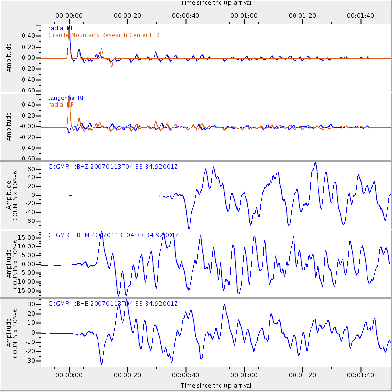
Earthquake location: East Of Kuril Islands
Earthquake latitude/longitude: 46.2/154.5
Earthquake time(UTC): 2007/01/13 (013) 04:23:21 GMT
Earthquake Depth: 10 km
Earthquake Magnitude: 7.3 MB, 8.2 MS, 8.1 MW, 7.9 MW
Earthquake Catalog/Contributor: WHDF/NEIC
Network: CI Caltech Regional Seismic Network
Station: GMR Granite Mountains Research Center
Lat/Lon: 34.78 N/115.66 W
Elevation: 1326 m
Distance: 65.8 deg
Az: 64.52 deg
Baz: 310.432 deg
Ray Param: 0.05806626
Estimated Moho Depth: 23.75 km
Estimated Crust Vp/Vs: 1.92
Assumed Crust Vp: 6.276 km/s
Estimated Crust Vs: 3.26 km/s
Estimated Crust Poisson's Ratio: 0.32
Radial Match: 96.624535 %
Radial Bump: 400
Transverse Match: 87.56025 %
Transverse Bump: 400
SOD ConfigId: 2564
Insert Time: 2010-03-05 21:57:01.207 +0000
GWidth: 2.5
Max Bumps: 400
Tol: 0.001

Signal To Noise

ChannelStoNSTALTA
CI:GMR: :BHN:20070113T04:33:34.92001Z3.63838394.5453947E-71.2492895E-7
CI:GMR: :BHE:20070113T04:33:34.92001Z6.96020468.716037E-71.2522673E-7
CI:GMR: :BHZ:20070113T04:33:34.92001Z11.2444152.0111506E-61.7885773E-7
Arrivals
Ps3.6 SECOND
PpPs11 SECOND
PsPs/PpSs14 SECOND