You are here: Home > Network List > TA - USArray Transportable Network (new EarthScope stations) Stations List
> Station D25K Kavik River, AK, USA > Earthquake Result Viewer
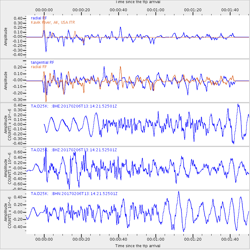
D25K Kavik River, AK, USA - Earthquake Result Viewer
*The percent match for this event was below the threshold and hence no stack was calculated.
| Earthquake location: |
Colombia |
| Earthquake latitude/longitude: |
3.4/-74.7 |
| Earthquake time(UTC): |
2017/02/06 (037) 13:02:45 GMT |
| Earthquake Depth: |
38 km |
| Earthquake Magnitude: |
5.5 Mww |
| Earthquake Catalog/Contributor: |
NEIC PDE/us |
|
| Network: |
TA USArray Transportable Network (new EarthScope stations) |
| Station: |
D25K Kavik River, AK, USA |
| Lat/Lon: |
69.32 N/146.38 W |
| Elevation: |
770 m |
|
| Distance: |
80.4 deg |
| Az: |
339.998 deg |
| Baz: |
105.997 deg |
| Ray Param: |
$rayparam |
*The percent match for this event was below the threshold and hence was not used in the summary stack. |
|
| Radial Match: |
66.1366 % |
| Radial Bump: |
400 |
| Transverse Match: |
58.46191 % |
| Transverse Bump: |
400 |
| SOD ConfigId: |
11737051 |
| Insert Time: |
2019-04-26 18:18:03.035 +0000 |
| GWidth: |
2.5 |
| Max Bumps: |
400 |
| Tol: |
0.001 |
|
Signal To Noise
| Channel | StoN | STA | LTA |
| TA:D25K: :BHZ:20170206T13:14:21.52501Z | 1.8605089 | 2.7152495E-7 | 1.4594123E-7 |
| TA:D25K: :BHN:20170206T13:14:21.52501Z | 0.6852908 | 9.9462646E-8 | 1.4513934E-7 |
| TA:D25K: :BHE:20170206T13:14:21.52501Z | 1.0811713 | 1.0804157E-7 | 9.993011E-8 |
| Arrivals |
| Ps | |
| PpPs | |
| PsPs/PpSs | |


