You are here: Home > Network List > TA - USArray Transportable Network (new EarthScope stations) Stations List
> Station MDND Maddock, ND, USA > Earthquake Result Viewer
MDND Maddock, ND, USA - Earthquake Result Viewer
*The percent match for this event was below the threshold and hence no stack was calculated.
| Earthquake location: |
Colombia |
| Earthquake latitude/longitude: |
3.4/-74.7 |
| Earthquake time(UTC): |
2017/02/06 (037) 13:02:45 GMT |
| Earthquake Depth: |
38 km |
| Earthquake Magnitude: |
5.5 Mww |
| Earthquake Catalog/Contributor: |
NEIC PDE/us |
|
| Network: |
TA USArray Transportable Network (new EarthScope stations) |
| Station: |
MDND Maddock, ND, USA |
| Lat/Lon: |
47.85 N/99.60 W |
| Elevation: |
479 m |
|
| Distance: |
49.2 deg |
| Az: |
337.958 deg |
| Baz: |
146.21 deg |
| Ray Param: |
$rayparam |
*The percent match for this event was below the threshold and hence was not used in the summary stack. |
|
| Radial Match: |
50.35068 % |
| Radial Bump: |
400 |
| Transverse Match: |
67.72086 % |
| Transverse Bump: |
400 |
| SOD ConfigId: |
11737051 |
| Insert Time: |
2019-04-26 18:18:17.020 +0000 |
| GWidth: |
2.5 |
| Max Bumps: |
400 |
| Tol: |
0.001 |
|
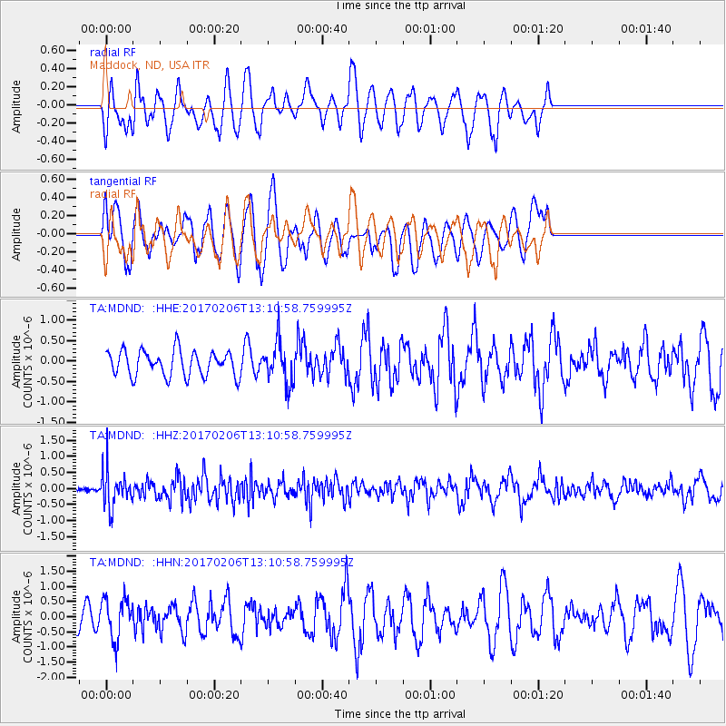
Signal To Noise
| Channel | StoN | STA | LTA |
| TA:MDND: :HHZ:20170206T13:10:58.759995Z | 3.694818 | 5.782322E-7 | 1.5649815E-7 |
| TA:MDND: :HHN:20170206T13:10:58.759995Z | 1.2215962 | 6.829655E-7 | 5.590763E-7 |
| TA:MDND: :HHE:20170206T13:10:58.759995Z | 1.6268134 | 5.0331374E-7 | 3.0938628E-7 |
| Arrivals |
| Ps | |
| PpPs | |
| PsPs/PpSs | |


