You are here: Home > Network List > US - United States National Seismic Network Stations List
> Station MSO Missoula, Montana, USA > Earthquake Result Viewer
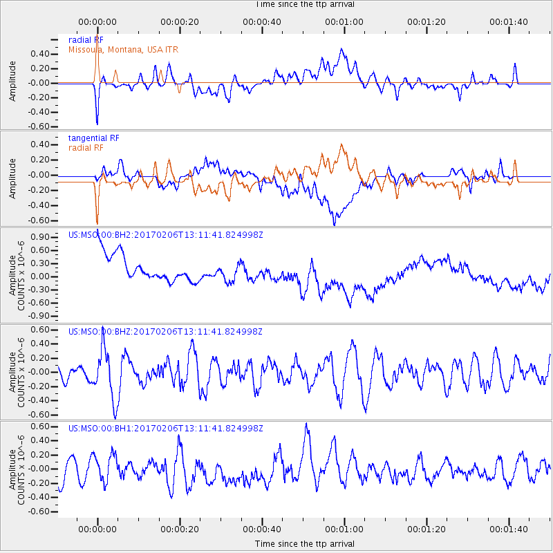
MSO Missoula, Montana, USA - Earthquake Result Viewer
*The percent match for this event was below the threshold and hence no stack was calculated.
| Earthquake location: |
Colombia |
| Earthquake latitude/longitude: |
3.4/-74.7 |
| Earthquake time(UTC): |
2017/02/06 (037) 13:02:45 GMT |
| Earthquake Depth: |
38 km |
| Earthquake Magnitude: |
5.5 Mww |
| Earthquake Catalog/Contributor: |
NEIC PDE/us |
|
| Network: |
US United States National Seismic Network |
| Station: |
MSO Missoula, Montana, USA |
| Lat/Lon: |
46.83 N/113.94 W |
| Elevation: |
1264 m |
|
| Distance: |
55.0 deg |
| Az: |
327.942 deg |
| Baz: |
129.498 deg |
| Ray Param: |
$rayparam |
*The percent match for this event was below the threshold and hence was not used in the summary stack. |
|
| Radial Match: |
38.178085 % |
| Radial Bump: |
400 |
| Transverse Match: |
31.730312 % |
| Transverse Bump: |
400 |
| SOD ConfigId: |
11737051 |
| Insert Time: |
2019-04-26 18:19:07.163 +0000 |
| GWidth: |
2.5 |
| Max Bumps: |
400 |
| Tol: |
0.001 |
|
Signal To Noise
| Channel | StoN | STA | LTA |
| US:MSO:00:BHZ:20170206T13:11:41.824998Z | 2.5042782 | 3.6216395E-7 | 1.446181E-7 |
| US:MSO:00:BH1:20170206T13:11:41.824998Z | 0.7939757 | 1.789899E-7 | 2.2543497E-7 |
| US:MSO:00:BH2:20170206T13:11:41.824998Z | 0.72552663 | 2.1400182E-7 | 2.9496067E-7 |
| Arrivals |
| Ps | |
| PpPs | |
| PsPs/PpSs | |


