You are here: Home > Network List > US - United States National Seismic Network Stations List
> Station OGNE Ogallala, Nebraska, USA > Earthquake Result Viewer
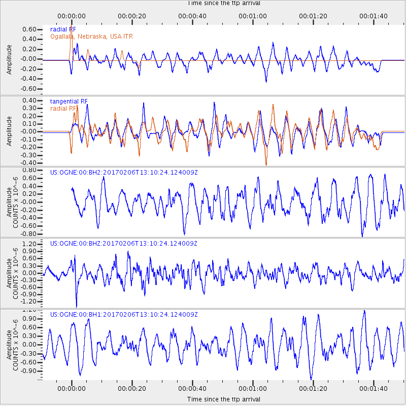
OGNE Ogallala, Nebraska, USA - Earthquake Result Viewer
*The percent match for this event was below the threshold and hence no stack was calculated.
| Earthquake location: |
Colombia |
| Earthquake latitude/longitude: |
3.4/-74.7 |
| Earthquake time(UTC): |
2017/02/06 (037) 13:02:45 GMT |
| Earthquake Depth: |
38 km |
| Earthquake Magnitude: |
5.5 Mww |
| Earthquake Catalog/Contributor: |
NEIC PDE/us |
|
| Network: |
US United States National Seismic Network |
| Station: |
OGNE Ogallala, Nebraska, USA |
| Lat/Lon: |
40.95 N/102.03 W |
| Elevation: |
1054 m |
|
| Distance: |
44.7 deg |
| Az: |
330.343 deg |
| Baz: |
139.305 deg |
| Ray Param: |
$rayparam |
*The percent match for this event was below the threshold and hence was not used in the summary stack. |
|
| Radial Match: |
61.8497 % |
| Radial Bump: |
400 |
| Transverse Match: |
55.492626 % |
| Transverse Bump: |
400 |
| SOD ConfigId: |
11737051 |
| Insert Time: |
2019-04-26 18:19:08.904 +0000 |
| GWidth: |
2.5 |
| Max Bumps: |
400 |
| Tol: |
0.001 |
|
Signal To Noise
| Channel | StoN | STA | LTA |
| US:OGNE:00:BHZ:20170206T13:10:24.124009Z | 2.5350482 | 4.568514E-7 | 1.802141E-7 |
| US:OGNE:00:BH1:20170206T13:10:24.124009Z | 1.3729203 | 6.205784E-7 | 4.5201347E-7 |
| US:OGNE:00:BH2:20170206T13:10:24.124009Z | 0.69075865 | 1.6814538E-7 | 2.434213E-7 |
| Arrivals |
| Ps | |
| PpPs | |
| PsPs/PpSs | |


