
GMR Granite Mountains Research Center - Earthquake Result Viewer
| ||||||||||||||||||
| ||||||||||||||||||
| ||||||||||||||||||
|

Signal To Noise
| Channel | StoN | STA | LTA |
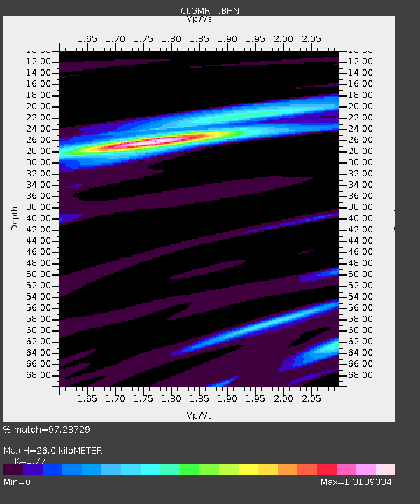
| CI:GMR: :BHN:20081019T05:22:03.120022Z | 85.93209 | 7.632896E-6 | 8.882475E-8 |
| CI:GMR: :BHE:20081019T05:22:03.120022Z | 34.7255 | 2.23459E-6 | 6.4350125E-8 |
| CI:GMR: :BHZ:20081019T05:22:03.120022Z | 20.473316 | 2.3778355E-6 | 1.1614315E-7 |
| Arrivals | |
| Ps | 3.3 SECOND |
| PpPs | 11 SECOND |
| PsPs/PpSs | 14 SECOND |

