GMR Granite Mountains Research Center - Earthquake Result Viewer
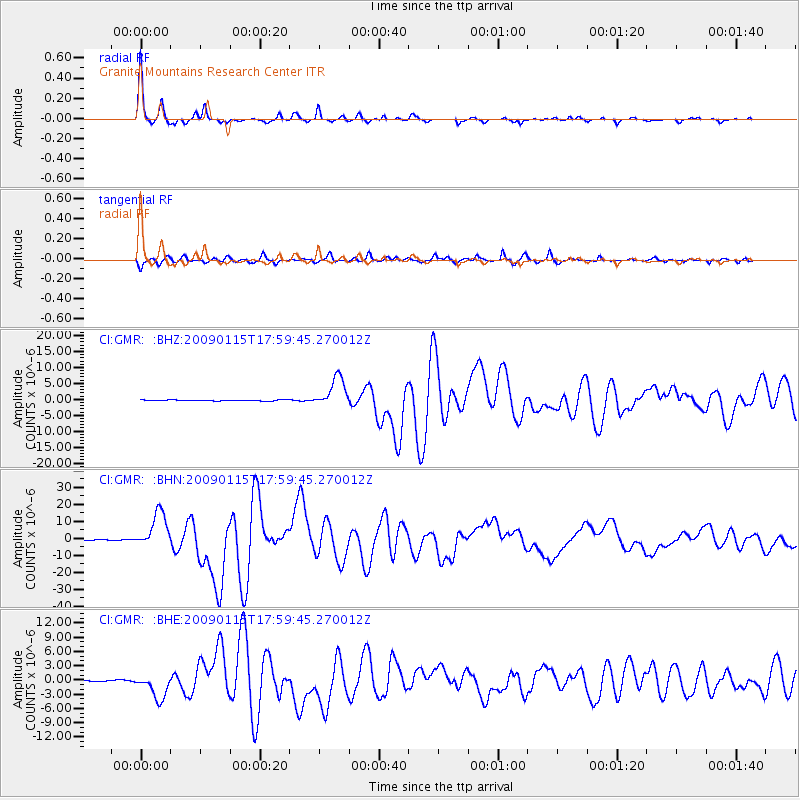
Earthquake location: East Of Kuril Islands
Earthquake latitude/longitude: 46.9/155.2
Earthquake time(UTC): 2009/01/15 (015) 17:49:39 GMT
Earthquake Depth: 36 km
Earthquake Magnitude: 6.9 MB, 7.5 MS, 7.4 MW, 7.4 MW
Earthquake Catalog/Contributor: WHDF/NEIC
Network: CI Caltech Regional Seismic Network
Station: GMR Granite Mountains Research Center
Lat/Lon: 34.78 N/115.66 W
Elevation: 1326 m
Distance: 65.1 deg
Az: 65.146 deg
Baz: 310.84 deg
Ray Param: 0.058434967
Estimated Moho Depth: 24.5 km
Estimated Crust Vp/Vs: 1.89
Assumed Crust Vp: 6.276 km/s
Estimated Crust Vs: 3.321 km/s
Estimated Crust Poisson's Ratio: 0.31
Radial Match: 98.32178 %
Radial Bump: 249
Transverse Match: 93.61087 %
Transverse Bump: 400
SOD ConfigId: 2834
Insert Time: 2010-03-05 21:58:08.496 +0000
GWidth: 2.5
Max Bumps: 400
Tol: 0.001

Signal To Noise

ChannelStoNSTALTA
CI:GMR: :BHN:20090115T17:59:45.270012Z53.057981.0712463E-52.0190109E-7
CI:GMR: :BHE:20090115T17:59:45.270012Z21.7329062.6665473E-61.226963E-7
CI:GMR: :BHZ:20090115T17:59:45.270012Z27.4000034.710437E-61.7191375E-7
Arrivals
Ps3.6 SECOND
PpPs11 SECOND
PsPs/PpSs14 SECOND