You are here: Home > Network List > IU - Global Seismograph Network (GSN - IRIS/USGS) Stations List
> Station POHA Pohakuloa, Hawaii, USA > Earthquake Result Viewer
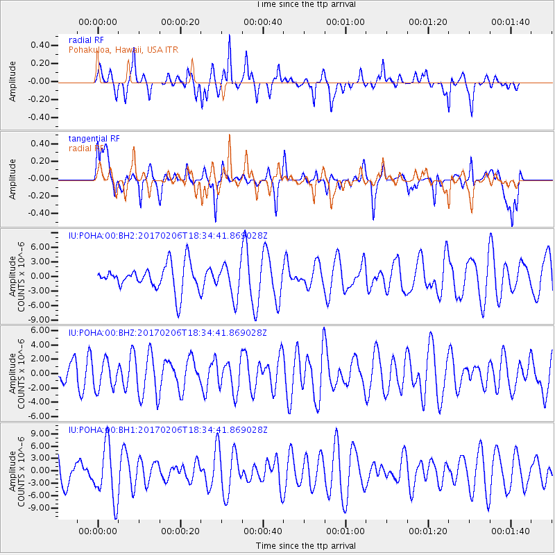
POHA Pohakuloa, Hawaii, USA - Earthquake Result Viewer
*The percent match for this event was below the threshold and hence no stack was calculated.
| Earthquake location: |
Pacific-Antarctic Ridge |
| Earthquake latitude/longitude: |
-57.0/-150.6 |
| Earthquake time(UTC): |
2017/02/06 (037) 18:23:22 GMT |
| Earthquake Depth: |
10 km |
| Earthquake Magnitude: |
5.3 Mwb |
| Earthquake Catalog/Contributor: |
NEIC PDE/us |
|
| Network: |
IU Global Seismograph Network (GSN - IRIS/USGS) |
| Station: |
POHA Pohakuloa, Hawaii, USA |
| Lat/Lon: |
19.76 N/155.53 W |
| Elevation: |
1990 m |
|
| Distance: |
76.5 deg |
| Az: |
355.239 deg |
| Baz: |
177.233 deg |
| Ray Param: |
$rayparam |
*The percent match for this event was below the threshold and hence was not used in the summary stack. |
|
| Radial Match: |
65.531456 % |
| Radial Bump: |
357 |
| Transverse Match: |
60.080387 % |
| Transverse Bump: |
400 |
| SOD ConfigId: |
11737051 |
| Insert Time: |
2019-04-26 18:29:42.102 +0000 |
| GWidth: |
2.5 |
| Max Bumps: |
400 |
| Tol: |
0.001 |
|
Signal To Noise
| Channel | StoN | STA | LTA |
| IU:POHA:00:BHZ:20170206T18:34:41.869028Z | 0.67872226 | 1.9727734E-6 | 2.9065986E-6 |
| IU:POHA:00:BH1:20170206T18:34:41.869028Z | 2.065159 | 6.8809645E-6 | 3.3319295E-6 |
| IU:POHA:00:BH2:20170206T18:34:41.869028Z | 1.3184303 | 3.5248786E-6 | 2.6735418E-6 |
| Arrivals |
| Ps | |
| PpPs | |
| PsPs/PpSs | |


