You are here: Home > Network List > TA - USArray Transportable Network (new EarthScope stations) Stations List
> Station 833A Chaparral WMA, Artesia Wells, TX, USA > Earthquake Result Viewer
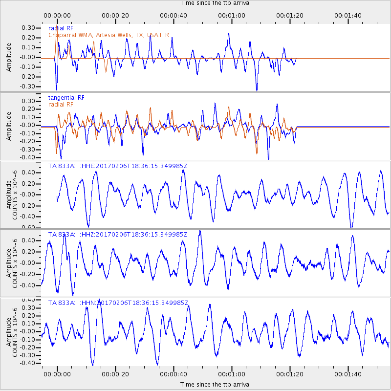
833A Chaparral WMA, Artesia Wells, TX, USA - Earthquake Result Viewer
*The percent match for this event was below the threshold and hence no stack was calculated.
| Earthquake location: |
Pacific-Antarctic Ridge |
| Earthquake latitude/longitude: |
-57.0/-150.6 |
| Earthquake time(UTC): |
2017/02/06 (037) 18:23:22 GMT |
| Earthquake Depth: |
10 km |
| Earthquake Magnitude: |
5.3 Mwb |
| Earthquake Catalog/Contributor: |
NEIC PDE/us |
|
| Network: |
TA USArray Transportable Network (new EarthScope stations) |
| Station: |
833A Chaparral WMA, Artesia Wells, TX, USA |
| Lat/Lon: |
28.32 N/99.39 W |
| Elevation: |
171 m |
|
| Distance: |
95.3 deg |
| Az: |
43.649 deg |
| Baz: |
205.398 deg |
| Ray Param: |
$rayparam |
*The percent match for this event was below the threshold and hence was not used in the summary stack. |
|
| Radial Match: |
51.579823 % |
| Radial Bump: |
400 |
| Transverse Match: |
54.327026 % |
| Transverse Bump: |
348 |
| SOD ConfigId: |
11737051 |
| Insert Time: |
2019-04-26 18:30:39.589 +0000 |
| GWidth: |
2.5 |
| Max Bumps: |
400 |
| Tol: |
0.001 |
|
Signal To Noise
| Channel | StoN | STA | LTA |
| TA:833A: :HHZ:20170206T18:36:15.349985Z | 1.8122176 | 3.2561846E-7 | 1.7967956E-7 |
| TA:833A: :HHN:20170206T18:36:15.349985Z | 1.0548308 | 8.595489E-8 | 8.1486895E-8 |
| TA:833A: :HHE:20170206T18:36:15.349985Z | 0.699997 | 1.6320173E-7 | 2.3314632E-7 |
| Arrivals |
| Ps | |
| PpPs | |
| PsPs/PpSs | |


