GMR Granite Mountains Research Center - Earthquake Result Viewer
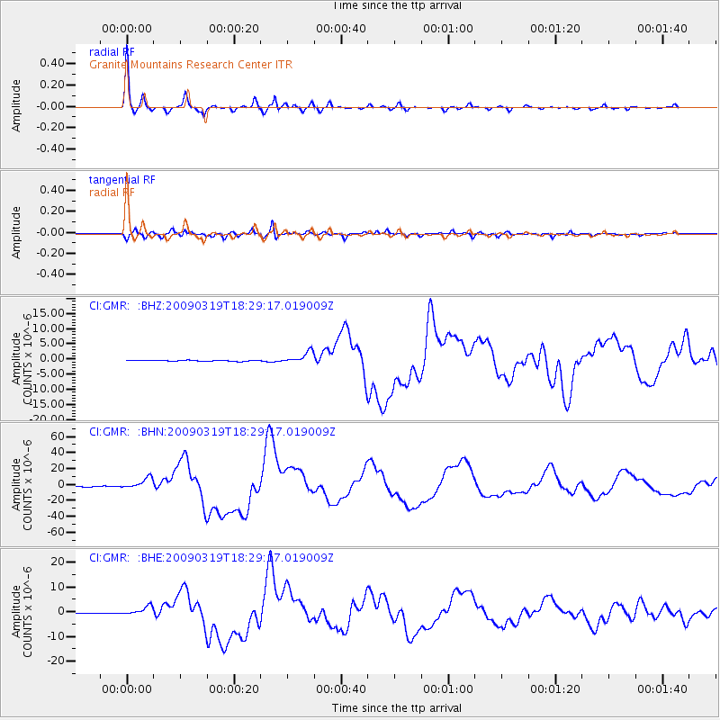
Earthquake location: Tonga Islands Region
Earthquake latitude/longitude: -23.0/-174.7
Earthquake time(UTC): 2009/03/19 (078) 18:17:40 GMT
Earthquake Depth: 34 km
Earthquake Magnitude: 7.0 MB, 7.6 MS, 7.6 MW, 7.6 MW
Earthquake Catalog/Contributor: WHDF/NEIC
Network: CI Caltech Regional Seismic Network
Station: GMR Granite Mountains Research Center
Lat/Lon: 34.78 N/115.66 W
Elevation: 1326 m
Distance: 80.2 deg
Az: 45.715 deg
Baz: 233.239 deg
Ray Param: 0.048361886
Estimated Moho Depth: 26.25 km
Estimated Crust Vp/Vs: 1.75
Assumed Crust Vp: 6.276 km/s
Estimated Crust Vs: 3.596 km/s
Estimated Crust Poisson's Ratio: 0.26
Radial Match: 98.49523 %
Radial Bump: 304
Transverse Match: 95.93676 %
Transverse Bump: 400
SOD ConfigId: 2658
Insert Time: 2010-03-05 21:59:11.227 +0000
GWidth: 2.5
Max Bumps: 400
Tol: 0.001

Signal To Noise

ChannelStoNSTALTA
CI:GMR: :BHN:20090319T18:29:17.019009Z13.6790736.8882628E-65.035621E-7
CI:GMR: :BHE:20090319T18:29:17.019009Z13.1471221.8051509E-61.3730387E-7
CI:GMR: :BHZ:20090319T18:29:17.019009Z11.2754121.9451054E-61.7250859E-7
Arrivals
Ps3.2 SECOND
PpPs11 SECOND
PsPs/PpSs14 SECOND